


Browse by category
- Adaptive reuse
- Archaeology
- Arts and creativity
- Black heritage
- Buildings and architecture
- Communication
- Community
- Cultural landscapes
- Cultural objects
- Design
- Economics of heritage
- Environment
- Expanding the narrative
- Food
- Francophone heritage
- Indigenous heritage
- Intangible heritage
- Medical heritage
- Military heritage
- MyOntario
- Natural heritage
- Sport heritage
- Tools for conservation
- Women's heritage
- Home
- Adaptive reuse
- Archaeology
- Arts and creativity
- Black heritage
- Buildings and architecture
- Communication
- Community
- Cultural landscapes
- Cultural objects
- Design
- Economics of heritage
- Environment
- Expanding the narrative

Expanding the narrative
 This is part of a broader conversation about whose history is being told, about gender, people of colour and the economically disenfranchised, and others whose stories have been overlooked or intentionally omitted from the authorized discussion.
- Food
- Francophone heritage
- Indigenous heritage
- Intangible heritage
Intangible heritage
Intangible cultural heritage includes language, traditions, music, food, special skills, etc.
- Medical heritage
- Military heritage
- MyOntario
- Natural heritage
- Sport heritage
- Tools for conservation
- Women's heritage
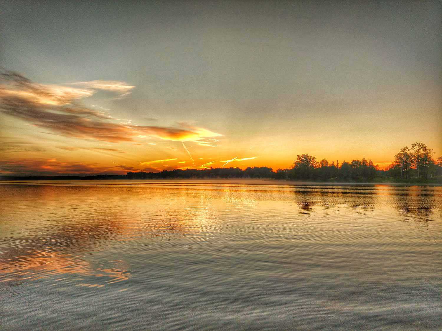
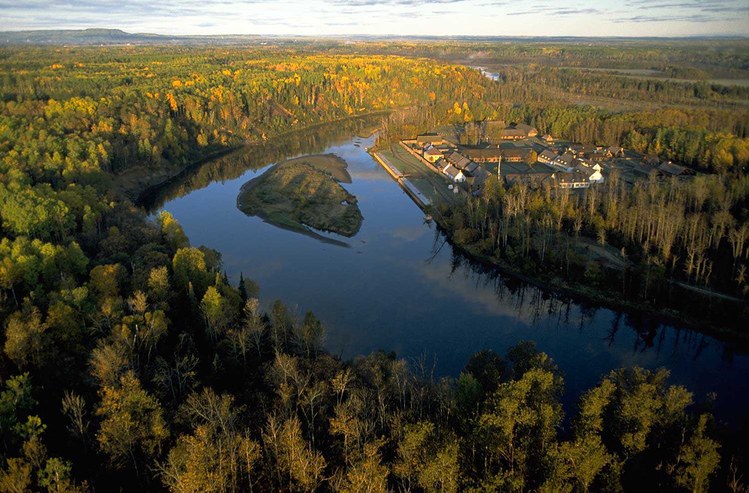
Along the Ottawa River

"The Ottawa River Heritage Designation Committee looks forward to the day that this important Canadian River, arguably its greatest, will fully join the Canadian Heritage Rivers System. Designation will provide the opportunity for communities both large and small, from Hawkesbury to Haileybury, to join together in celebration of the Ottawa’s rich cultural heritage and its world-class recreational activities."
Larry Graham, lifelong resident of the Ottawa River, avid paddler and Chair of the Ottawa River Heritage Designation Committee
The original Trans-Canada Highway
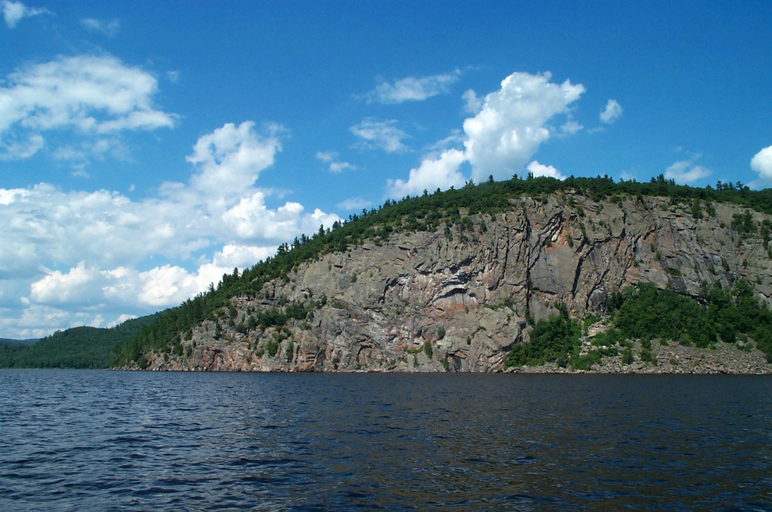
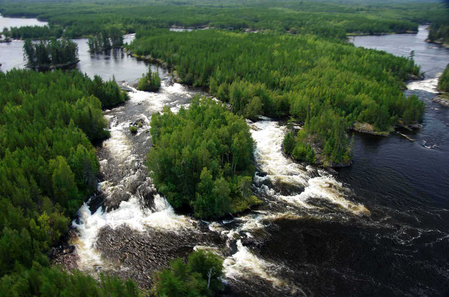
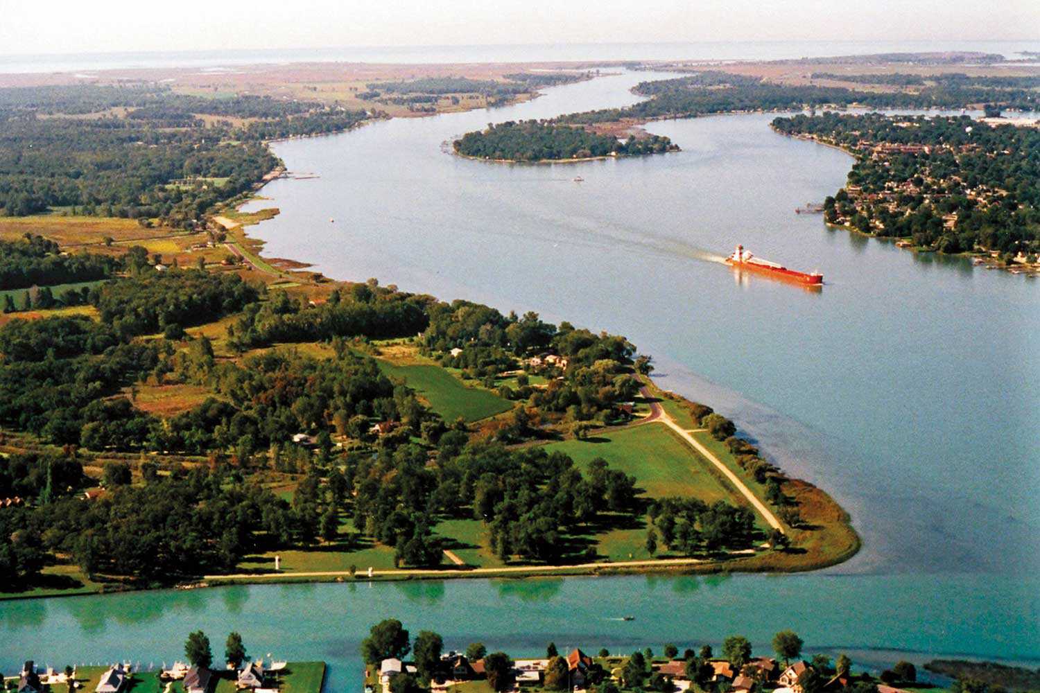
The Ottawa River is one of Canada’s most important transportation routes, playing an integral role in many of the key stories that comprise Canada’s history. From the area’s first inhabitants to the explorers, guides, traders, loggers, settlers and entrepreneurs that followed, the Ottawa River was truly the original Trans-Canada Highway.
In the Algonquin language, the Ottawa River is known as Kitchissippi – meaning Big River. The name “Ottawa” is derived from the Algonquin term adawe (“to trade”). The river’s source is at Lake Capimitchigama in Quebec, 250 km (156 miles) north of Ottawa. It flows approximately 1,300 km (807 miles) to the St. Lawrence, forming the border between Ontario and Quebec for most of its length.
The canoe was the primary method of transportation for First Nations living in the Ottawa Valley for thousands of years. Evidence from as early as 6,000 years ago suggests that a wide trade and communication network was enabled by the Ottawa River and its tributaries.
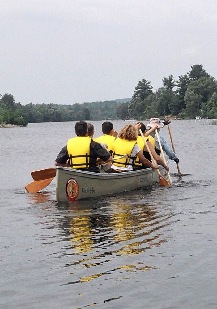
Paddlers with the Ottawa River Canoe Brigade. The brigade inspires participants to connect with the river’s heritage and share in its safe keeping. (Photo courtesy of Larry Graham)
Originally built and used by aboriginal traders, the canoe later became pivotal in the exploration and development of the Canadian wilderness by European explorers, settlers and industrialists. In the 18th and 19th centuries, France’s North American colonial economy depended on the fur trade, which relied on the famous waterway routes that began and ended with the Ottawa River. This era saw the expansion of the country through the courageous coureurs de bois and voyageurs, travelling in bark canoes, as well as the beginnings of the Hudson’s Bay Company. Voyageur life remains fixed in Canadian imagery by artists such as Frances Anne Hopkins who captured the lifestyle in her first-hand account paintings. Hopkins painted in the 1870s, an era when use of the canoe for trade and transportation had already begun to wane, and the Hudson’s Bay Company was replacing the canoe with steamboat and rail transport.
The first recorded European contact in Algonquin Territory was with Samuel de Champlain in 1613 on the Kitchissippi (the Ottawa River). On this journey, he meets with members of at least three different bands of the Algonquin Nation along the Kitchissippi.
The last band he meets with is the Kichesipirini, the Big River people, at present-day Morrison’s Island near Pembroke, Ontario. Champlain went to proceed farther upriver, but while he is treated very well and cordially by the Kichesipirini, Chief Tessouat does not allow him to pass. The Kichesipirini and their Chief Tessouat decided which non-Algonquins could pass up and down the Kitchissippi and levied tolls on those who were allowed to pass, including explorers and missionaries. Along the river and its many tributaries, there are many Algonquin archaeological, sacred and burial sites that attest to long occupation and use. [Chief Kirby Whiteduck, Algonquins of Pikwakanagan First Nation]
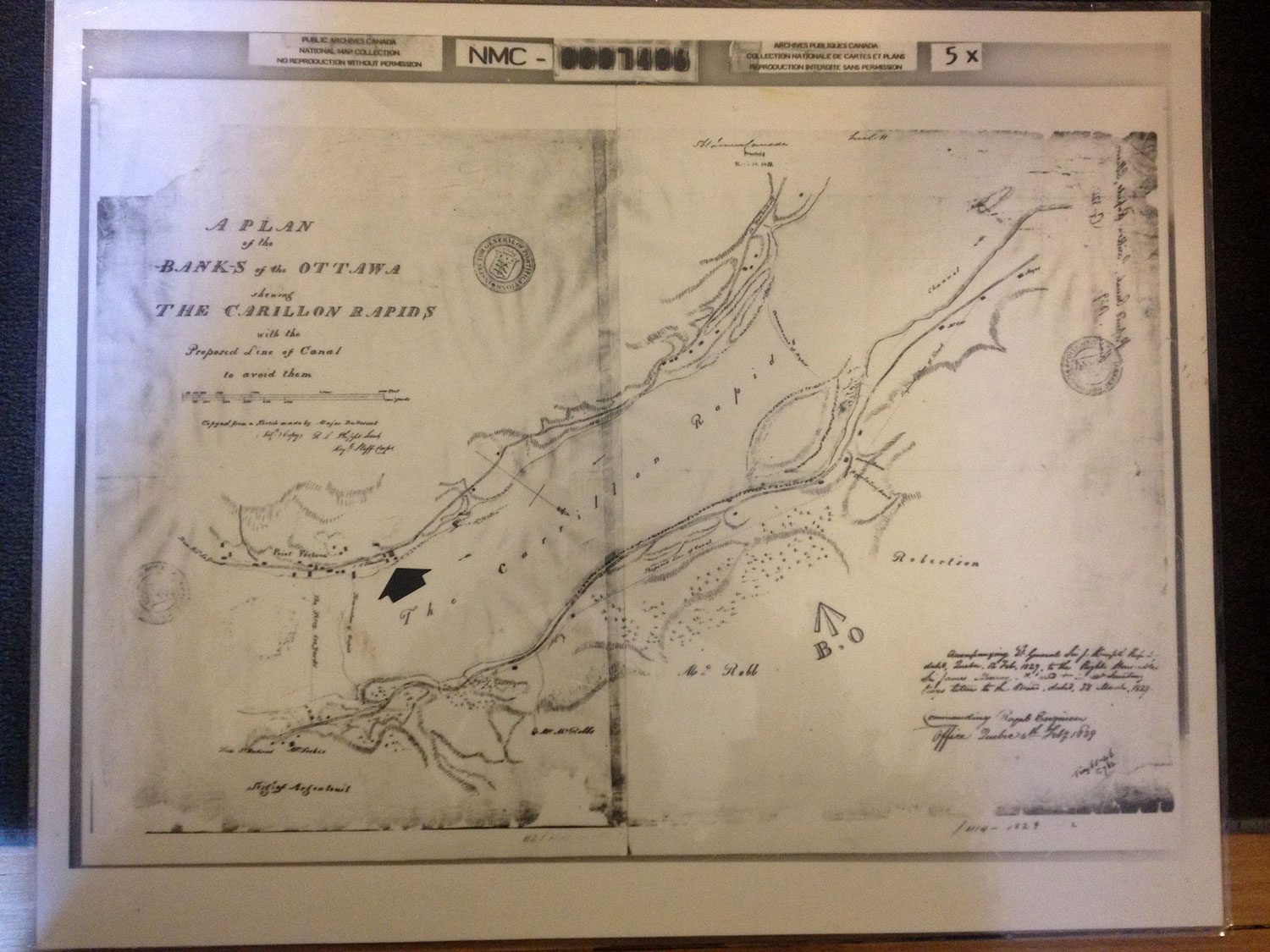
Bypassing the rapids of the Ottawa River has been a challenge since early trade routes were established by Canada’s aboriginal people. Portage routes were used to get around the rapids, followed by basic canal systems. Entrepreneur John Macdonell took advantage of this high-traffic trade route by building his house on a strategic bluff on the Ontario shore of Ottawa River in 1817 and constructing a simple canal to avoid the raging rapids. By the 1830s, Macdonell’s canal was insufficient to serve the growing importance of the Ottawa River as a trade route and a strategic bypass to the other Great Lakes in the event of a war with the United States. In the 1830s, a more sophisticated canal system was built by the British army. It consisted of the Grenville Canal, the Chute-à-Blondeau Canal and the Carillon Canal.
Although the early canals built on the Ottawa River were intended primarily for military purposes, the area’s natural resources became an economic force that would alter the Ottawa River and its shores. Large sawmills were established close to falls and rapids for the production of hydraulic energy (and later hydroelectric energy) required to operate local mills. Mills attracted settlers, and communities such as Bytown (present-day Ottawa) grew around them.
One of the most dramatic changes to the Ottawa River occurred from 1959 to 1962 when Hydro Quebec constructed a dam at Carillon, across from Macdonell-Williamson House, to supply power to Montreal. The dam raised water levels, flooding the former Carillon and Grenville canals and silencing the rapids. Its official opening in 1963 marked the end of commercial navigation on the Ottawa River system.
While no longer used for trade and shipping of goods, the Ottawa River is now explored in power boats, rafts, kayaks, sail boats and canoes. Canoes are still treasured by those looking for a relaxing way to explore the natural beauty and cultural sites of the Ottawa River.
Sources: This article only scratches the surface and readers are encouraged to visit the Ottawa River Heritage Designation Committee’s website at www.ottawariver.org. The Trust gratefully acknowledges the Designation Committee for use of A Background Study for Nomination of the Ottawa River Under the Canadian Heritage Rivers System (2005), which forms the basis of this article. A special thank you to Larry Graham, Chairman of the Ottawa River Heritage Designation Committee and Chief Kirby Whiteduck for speaking with Trust staff and for sharing their understanding and experiences of the Ottawa River.
The river through history
- 15,000 years ago Laurentide ice sheet (glacier) begins to melt away. As the glaciers retreat, saltwater from the Atlantic Ocean floods the valley to form the Champlain Sea.
- 13,000 years ago Ottawa Valley is covered by the Champlain Sea.
- 10,000 years ago Champlain Sea recedes. 8,500 years ago Earliest evidence of human presence along the Ottawa River.
- 8,000 years ago Present drainage system of the Ottawa River Valley established.
- 6,000 years ago Ottawa River gradually drops to its traditional level, and forests of white pine become mixed forests of hemlock, pine and hardwoods.
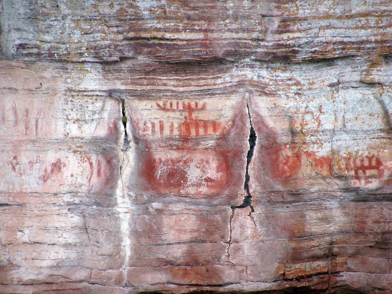
- 3,000 years ago Pictographs representing traditional understanding of the spiritual and physical landscape to the Algonquin peoples are marked along the river’s banks.
- 1608: Étienne Brûlé is the first European to explore the Ottawa River.
- 1613: Samuel de Champlain travels up-river to the vicinity of present-day Pembroke. He is cordially greeted, but is refused passage by the Kichesipirini.
- 1817: John Macdonell builds his large Georgian house on a strategic bluff on the Ontario shore of the Ottawa River.
- 1857: Queen Victoria selects Ottawa, located on the shores of the river that bears the same name, as the capital of Canada.
- 1862: Pembroke industrialist McAllister uses water wheels in his mills to generate electricity for commercial purposes.
- 1885: Hydroelectric power generation begins on the Ontario side of the river.
- 1945: First self-contained nuclear reaction in Canada initiated at Chalk River Laboratories on the banks of the Ottawa River.
Ottawa River by the numbers
- 4: The number of major geological subdivisions crossed by the Ottawa River – Superior Province, Cobalt Plate, Grenville Province and St. Lawrence Lowlands.
- 33: Species of amphibian and reptiles, including the mudpuppy and common map turtle (at risk).
- 43: Dams in the Ottawa River watershed, making it one of the most highly regulated rivers in Canada.
- 45: Percentage of the watershed in Ontario (the rest is in Quebec).
- 80: Number of tributaries (two of which – the Mattawa and the Rideau – are designated Canadian Heritage Rivers).
- 80: Species at risk, including the loggerhead shrike, eastern cougar, bald eagle and American ginseng.
- 85: Species of fish observed in the river.
- 90: Deepest point (in metres) at the Carillon Reservoir.
- 150: Height (in metres) of the sacred Oiseau Rock that rises out of the Ottawa River in Pontiac County, Quebec.
- 300: Number of species of birds for which the Ottawa River watershed provides habitat.
- 1,271: Approximate length (in kilometres) of the Ottawa River.
- 14,000: Number of pleasure craft that have been noted annually in the Ottawa-Gatineau region.
- 146,300: The area of the watershed (in square kilometres) – twice the size of New Brunswick.
- 1,670,000: Number of people living in the watershed (2001 census data).
- 341,000,000: Litres of water taken from the river each day at the Britannia and Lemieux Islands water purification plants.
The Canadian Heritage Rivers System
While designation to the Canadian Heritage Rivers System offers no legal protection for the river, it is nonetheless a proven and effective community-based stewardship program that engages citizens in conserving and celebrating their rivers. Designation is an incredible honour that is reserved for rivers that the provincial and federal governments have recognized as having exceptional natural and/or cultural heritage.
RelatedStories
- 01 Oct 2019
- Indigenous heritage
Community - Author: Kayleigh Speirs and Art Hunter,
Present. Preserve. Protect.
Kay-Nah-Chi-Wah-Nung Historical Centre, the Place of the Long Rapids, is a historically significant meeting place located along the banks of Manidoo Ziibi (Spirit River or...![]()
- 20 Mar 2019
- Indigenous heritage
Communication - Author: Anne Taylor,
Kinomaage Waapkong – The Teaching Rocks
When one makes the journey to Kinomaage Waapkong – known in English as Petroglyph Provincial Park – one is struck by the incredible beauty of...![]()
- 20 Mar 2019
- Indigenous heritage
Communication - Author: Amber Lloydlangston and Bimadoshka Pucan,
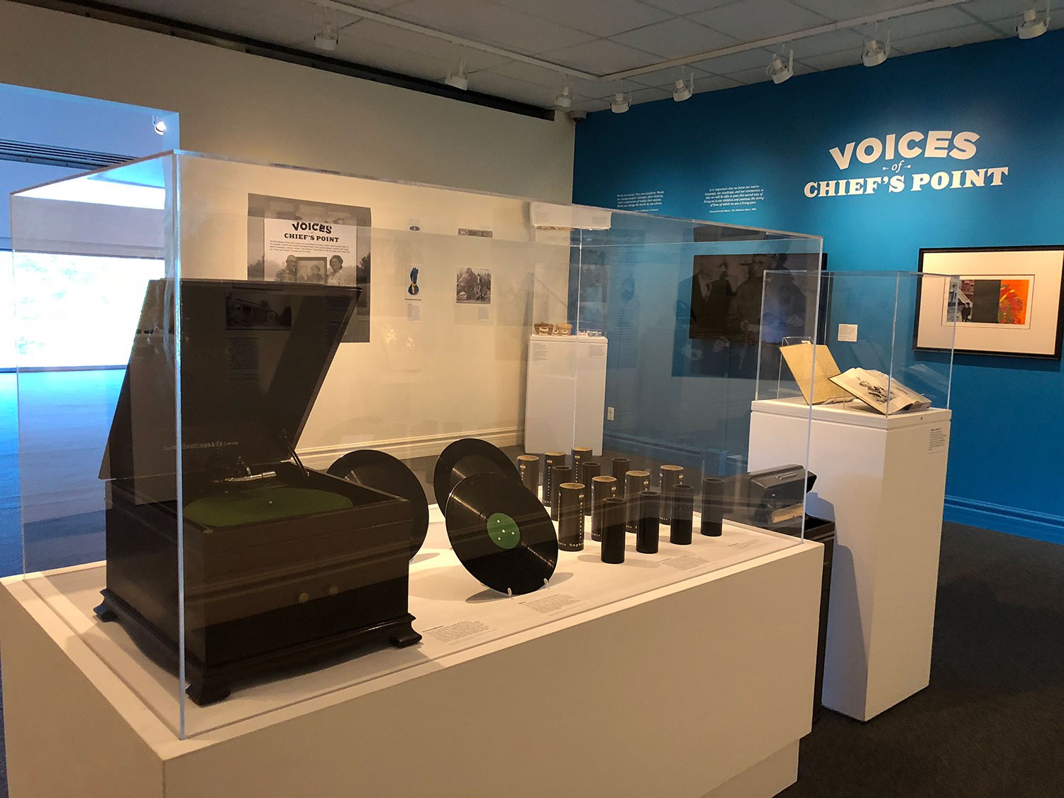
Voices of Chief’s Point
In 1938, Londoner Dr. Edwin Seaborn worked with Anishinaabe Elders, Pe-wak-a-nep (also known as Robert Thompson) and his wife Eliza to record Anishinaabeg stories and...![]()

- 20 Mar 2019
- Indigenous heritage
Communication - Author: Duncan McCue,
More than words: why I’m trying to learn the language of my ancestors
Losing our talk I’m from the Chippewas of Georgina Island First Nation in southern Ontario. My people refer to ourselves as Anishinaabe, which translates literally...![]()
- 07 Sep 2018
- Economics of heritage
Indigenous heritage - Author: Philip Cote,
Remembering our ancestors
“The importance of knowing your story is to have a sense of belonging and if you have this, you will have a sense of responsibility...![]()
- 07 Sep 2018
- Expanding the narrative
Indigenous heritage - Author: Gord Jones,
Pimachiowin Aki – Canada’s newest World Heritage Site
On July 1, 2018, during the 42nd Session of the World Heritage Committee in Manama, Bahrain, Pimachiowin Aki was inscribed on the UNESCO World Heritage...![]()
- 07 Sep 2018
- Expanding the narrative
Indigenous heritage - Author: Anne Taylor,
All land is sacred
According to all First Nations on Turtle Island, ALL LAND IS SACRED. We do not consider that some places are more sacred than others. All...![]()
- 20 Mar 2018
- Women's heritage
Indigenous heritage - Author: Dr. Cynthia Wesley-Esquimaux,
Suffrage and Indigenous women in Canada
What has it been like to grow up in a society only now beginning to take note and respect the contributions of Indigenous women? When...![]()
- 20 Mar 2018
- Women's heritage
Indigenous heritage - Author: Rita Rose,
Canada’s first elected woman chief
Elsie Knott was born at her Curve Lake home on September 20, 1922 to George and Esther Taylor, the fifth of six siblings. Because of...![]()
- 08 Sep 2017
- Intangible heritage
Indigenous heritage - Author: Taylor Gibson,
Still alive and speaking
When you consider the connection between language and culture, you need to keep in mind that you can never really fully understand a book translated...![]()
- 08 Sep 2017
- Intangible heritage
Indigenous heritage - Author: Dr. Brian Waabishki-makwa McInnes,
The Elders taught me
At its deepest level, culture frames how we see the world; the unique way that we think and act is intimately related to the perspectives...![]()

- 08 Sep 2017
- Intangible heritage
Indigenous heritage
Arts and creativity - Author: Rick Hill,
Clay connection – Indigenous living and creativity
A couple of decades ago, I witnessed a friendly debate between a white historian and an Indigenous ethnologist. The well known historian, who just happened...![]()
- 17 Feb 2017
- Natural heritage
- Author: Muhammad Qureshi,
Our natural fingerprint
The magic began on a cold autumn afternoon after a hockey game with friends. I was walking home through a trail and the leaves had...![]()
- 17 Feb 2017
- Indigenous heritage
Archaeology
MyOntario - Author: Jean-Luc Pilon,
The gift of time travel
In the summer of 1982, I was carrying out archaeological research near the shores of Hudson Bay on the Severn River. One of the sites...![]()
- 17 Feb 2017
- Indigenous heritage
MyOntario - Author: Konrad Sioui,
The heart of North America
There are many stories that we can share. Well, first of all, the word “Ontario” itself. Many people don’t know what it means. People try...![]()

- 17 Feb 2017
- Natural heritage
MyOntario - Author: Steve Paikin,
Heaven on earth
A month before Ontario turns 150 years old, I’ll celebrate my 57th birthday. I’ve lived all but one of those years in the province of...![]()
- 17 Feb 2017
- Natural heritage
MyOntario - Author: Yannick Bisson,
Reconnecting with nature
My first visit to Ontario, from Québec, was at about age 8. I have a distinct memory of arriving by car down the Don Valley...![]()
- 17 Feb 2017
- Indigenous heritage
MyOntario - Author: Josephine Mandamin,
Walking with the water
When we walk with the water, we pray for the water. The water that we carry, we pray for it, and we pray to it...![]()
- 17 Feb 2017
- Indigenous heritage
Buildings and architecture
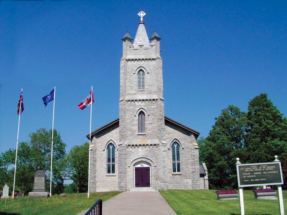
MyOntario - Author: R. Donald Maracle,
Christ Church, Her Majesty’s Chapel Royal of the Mohawk – Tyendinaga Mohawk Territory
During the American Revolution, the Mohawks were forced to flee their homeland in upper New York State. In 1784, after spending several years in Lachine...![]()
- 17 Feb 2017
- Natural heritage
MyOntario - Author: Joseph Desloges,
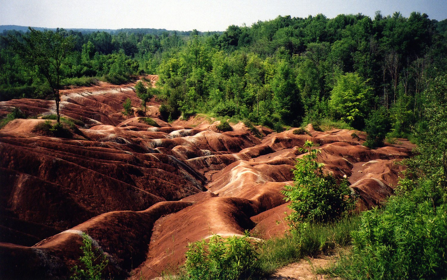
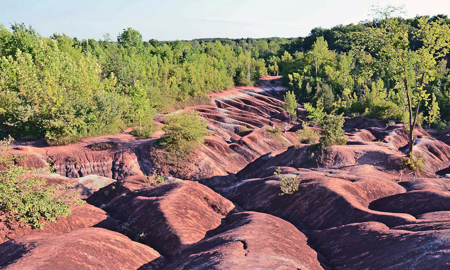
Celebrating the Chinguacousy Badlands
The Chinguacousy (“land of the young pines”) Badlands have been visited by hundreds of thousands of Ontarians. This rapidly eroding clay-shale bedrock at the foot...![]()
- 17 Feb 2017
- Indigenous heritage
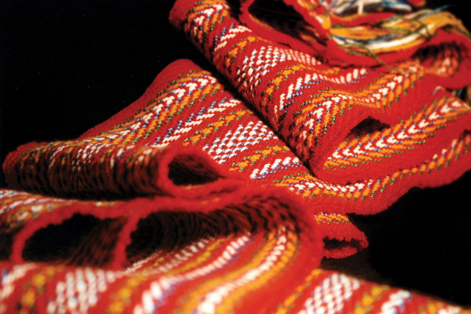
MyOntario - Author: M. Margaret Froh,
The Métis sash
Métis youth leader Katelyn LaCroix was recently asked what being Métis meant to her. She replied that “like the sash, we are two cultures coming...![]()
- 17 Feb 2017
- Indigenous heritage
MyOntario - Author: Mélanie-Rose Frappier,
On the path to reconciliation
Education is key. It will lead to healing as well as social awareness about the Indigenous culture. My ancestors spent hundreds of years fighting for...![]()
- 17 Feb 2017
- Indigenous heritage
MyOntario - Author: Susan Bryan,
Someone has passed this way before
I’m standing on the deck of a small boat, riding the swells of the Nipigon River where it widens into Lake Superior. In front of...![]()
- 17 Feb 2017
- Natural heritage
MyOntario - Author: Michael Runtz,
Drawn back to Algonquin
Being a lifelong naturalist whose goal has been to explore Ontario’s natural history, I’ve come to appreciate just how rich this province’s biodiversity is. The...![]()

- 12 Feb 2016
- Indigenous heritage
Medical heritage - Author: Ontario Heritage Trust,
Indigenous traditional medicine
“Traditional medicine” refers to knowledge and practices of Indigenous peoples that promote health and well-being, and that have been passed down from generation to generation...![]()
- 14 Feb 2014
- Indigenous heritage
- Author: Beth Hanna,
Thonnakona: Returning the ancestors to the land
On a calm, clear Saturday in September 2013, 1,760 Huron-Wendat ancestors were reburied at a secluded and peaceful meadow. Prior to the 17th century, the...![]()
- 12 Oct 2012
- Indigenous heritage
Food - Author: Ryan DeCaire,
Understanding indigenous agricultural systems
Throughout a long history, indigenous peoples – with their rich cultural diversities and complexities – have continued to live in a way that works to...![]()
- 31 May 2011
- Natural heritage
- Author: Patricia Lowe,
The Enniskillen Valley Land Acquisition Project: Making stewardship count
Through the Enniskillen Valley Land Acquisition Project, The Ontario Heritage Trust and the Central Lake Ontario Conservation Authority (CLOCA) have successfully partnered to acquire natural...![]()
- 31 May 2011
- Buildings and architecture
Natural heritage
Community
Tools for conservation - Author: Sean Fraser, Erin Semande and Mike Sawchuck,
Investing in preservation
It is an unfortunate reality that the preservation of our heritage remains the exception rather than the norm. What is a common-sense approach to living...![]()
- 07 Oct 2010
- Natural heritage
- Author: Andrew Sokolowski and Susie Cameron,
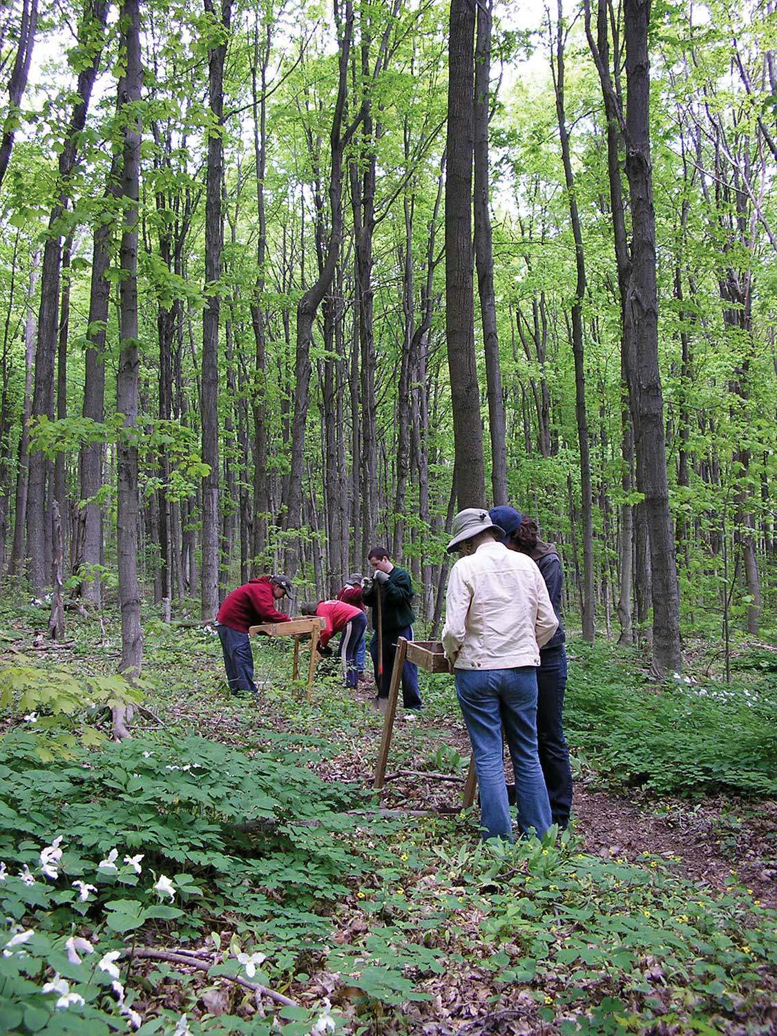
Reclaiming Fleetwood Creek
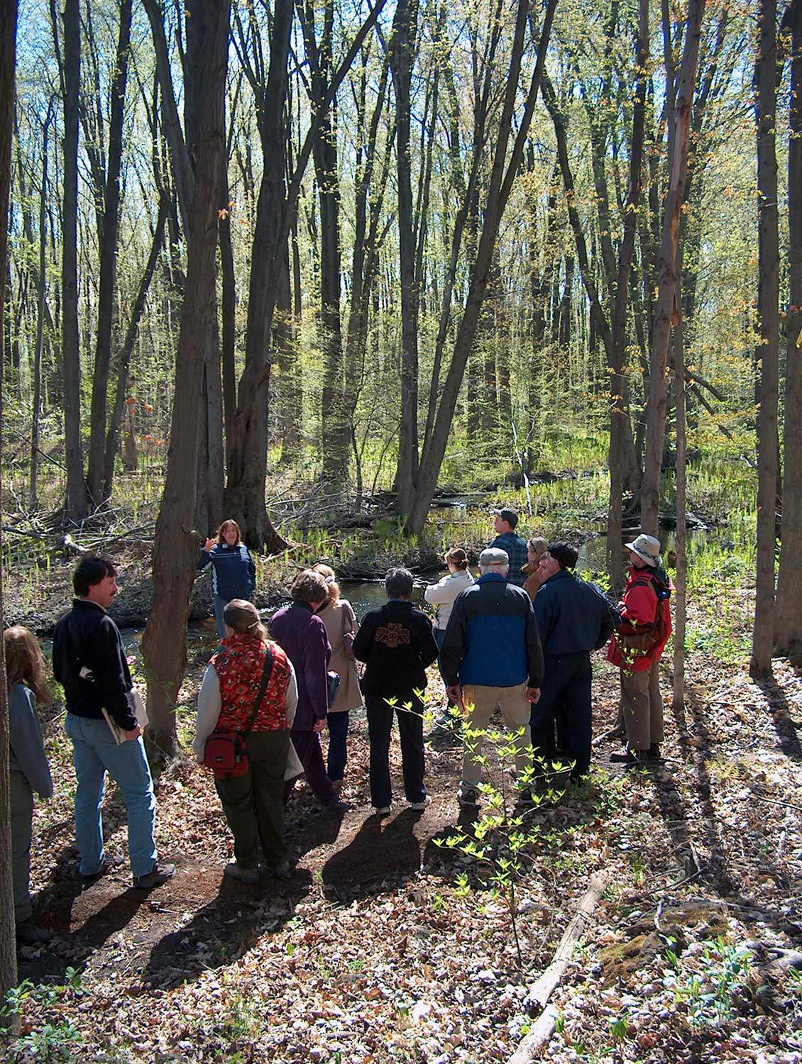
It’s hard to put a price on experience. Students enrolled in Sir Sandford Fleming College’s Ecosystem Management Technology (EMT) program understand this. During the program’s...![]()
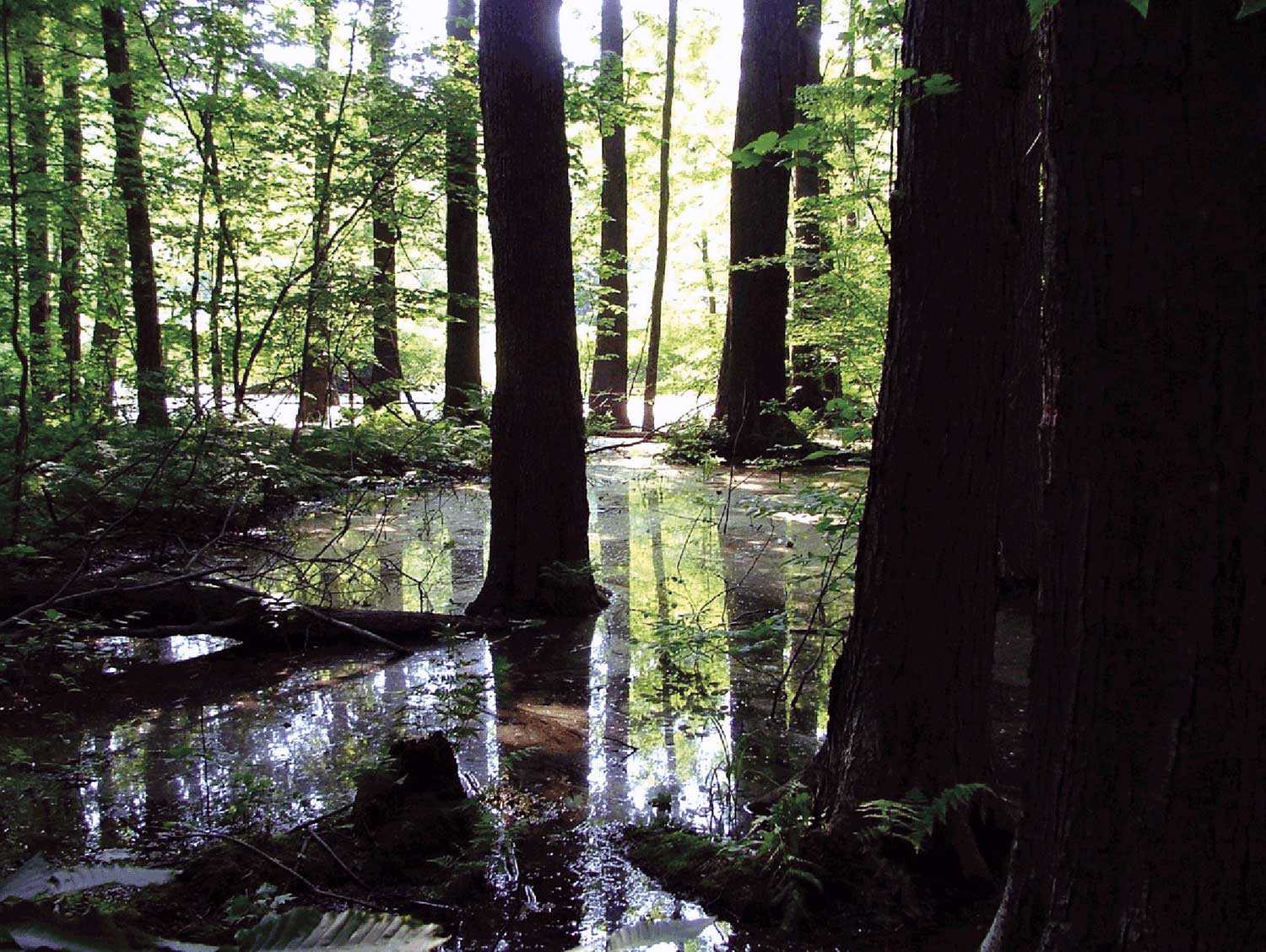
- 07 Oct 2010
- Natural heritage
- Author: Lesley Smith,
A plantation management strategy for Fleetwood Creek Natural Area
Fleetwood Creek Natural Area, a 360-hectare (890-acre) property on the Oak Ridges Moraine, is valued for its unique post-glacial geographic features, diverse resident breeding bird...![]()
- 07 Oct 2010
- Natural heritage
- Author: Jeremy Collins and Barbara Heidenreich,
Saving biodiversity, one property at a time
What do wetlands and forest nesting sites for northern goshawks in eastern Ontario have in common with south-central Ontario cold-water streams harbouring brook trout and...![]()
- 07 Oct 2010
- Environment
Natural heritage - Author: John Stille,
New life for an old property
Heritage restoration is not limited to old buildings. Natural heritage properties, too, can be restored or adapted to new uses for future generations to enjoy...![]()
- 07 Oct 2010
- Environment
Natural heritage - Author: Don Pearson, Barbara Heidenreich and Sean Fraser,
Biodiversity in Ontario: Taking up the challenge
Many are familiar with high-profile threatened species such as polar bears, whose habitat is in flux and whose numbers are dropping, or bald eagles, once...![]()
- 07 Oct 2010
- Environment
Natural heritage - Author: Rebecca Margel,
Working with stewards and partners
The Ontario Heritage Trust owns over 160 natural heritage properties and protects over 40 natural heritage sites with easements. Because the Trust cannot manage and...![]()
- 07 Oct 2010
- Natural heritage
- Author: Chris Earley and Brad Bass,
Enhancing urban biodiversity
Inside the Gosling Wildlife Gardens By Chris Earley Most gardeners are biodiversity geeks. “What little plant can I cram in there? Which spring bloomer can...![]()
- 11 Feb 2010
- Indigenous heritage
Archaeology - Author: Robert Pearce,
The archaeology of southwestern Ontario
Southwestern Ontario has an extremely rich and diverse cultural history dating back 11,000 years. We can follow human history and settlement through archaeology in this...![]()
- 11 Feb 2010
- Indigenous heritage
Natural heritage - Author: Clint Jacobs,
Bkejwanong: Sustaining a 6,000-year-old conservation legacy
Nestled at the mouth of the St. Clair River on Lake St. Clair in southwestern Ontario is the Walpole Island First Nation or “Bkejwanong,” meaning...![]()
- 10 Sep 2009
- Indigenous heritage
Buildings and architecture
Community - Author: Yves Frenette,
Churches of “New Ontario”
In the middle of the 19th century, northern Ontario remained much as it had been under the French regime – a region of Catholic missions...![]()

- 10 Sep 2009
- Indigenous heritage
Buildings and architecture
Francophone heritage
Community - Author: Wayne Kelly,
Ontario’s rich religious heritage
From the First People who for thousands of years conducted religious and cultural ceremonies at places they believed held spiritual significance, to subsequent arrivals who...![]()
- 10 Sep 2009
- Indigenous heritage
Buildings and architecture
Community
Cultural objects - Author: Kathryn McLeod,
Christ Church and the Queen Anne Silver
Located in Tyendinaga Mohawk Territory on the Bay of Quinte, Christ Church houses a silver communion service dating to 1712. This remarkable service represents an...![]()
- 28 May 2009
- Buildings and architecture
Natural heritage
Community - Author: Tamara Chipperfield and Kiki Aravopoulos,
Heritage in harmony: The integration of natural and cultural landscapes
Approximately 11,000 years of human culture are recorded in Ontario’s landscapes. Most existing natural landscapes in Ontario today have intrinsic cultural heritage meaning and significance...![]()
- 28 May 2009
- Indigenous heritage
Environment - Author: Ontario Heritage Trust,
Resources: Heritage in the new economy - Making sense of sustainability
What's on the shelf The Shield, part of the Ontario Visual Heritage Project. Over thousands of years, a select few have carved out lives for...![]()

- 28 May 2009
- Environment
Natural heritage - Author: Meagan McKeen,
Working for change
Protecting the environment and natural heritage has become an important part of my life over the past few years. While busy as a Grade 1...![]()
- 12 Feb 2009
- Natural heritage
- Author: Tamara Chipperfield,
Protecting Ottawa’s Carp Hills
Just north of the Village of Carp lie the Carp Hills – one of the largest and wildest natural areas within the City of Ottawa...![]()
- 12 Jun 2008
- Natural heritage
- Author: Gordon Pim,
Along the Arctic Watershed
The Arctic Watershed follows an erratic course of some 2,240 kilometres (1,400 miles) across northern Ontario. It marks the point where rivers and streams in...![]()
- 15 Nov 2007
- Environment
Natural heritage - Author: Tony Buszynski, with photographs by Karen Abel,
Sustaining species at risk
Ontario, with its broad geography, is blessed with incredible biologically diverse landscapes. Most of us take this amazing biodiversity for granted and do not fully...![]()
- 15 Nov 2007
- Environment
Natural heritage - Author: Tony Buszynski,
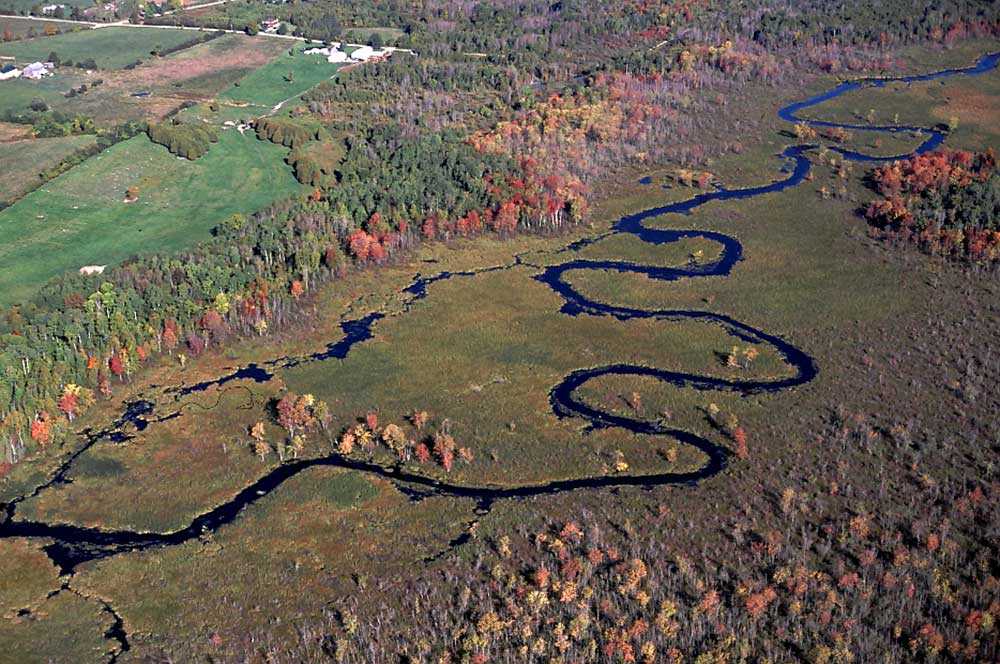
Exploring the Beaver River Wetland
In June 2007, the Lake Simcoe Region Conservation Authority (LSRCA) hosted a celebration to recognize the private and public efforts to protect two recently acquired...![]()
- 10 May 2007
- Archaeology
Natural heritage - Author: Dena Doroszenko and Sean Fraser,
Tools through time: Protecting the past for the future
Identifying and protecting places in our communities that have cultural heritage value is an important part of managing change. Heritage buildings, archaeological sites and cultural...![]()
- 10 May 2007
- Environment
Natural heritage - Author: Karen Abel,
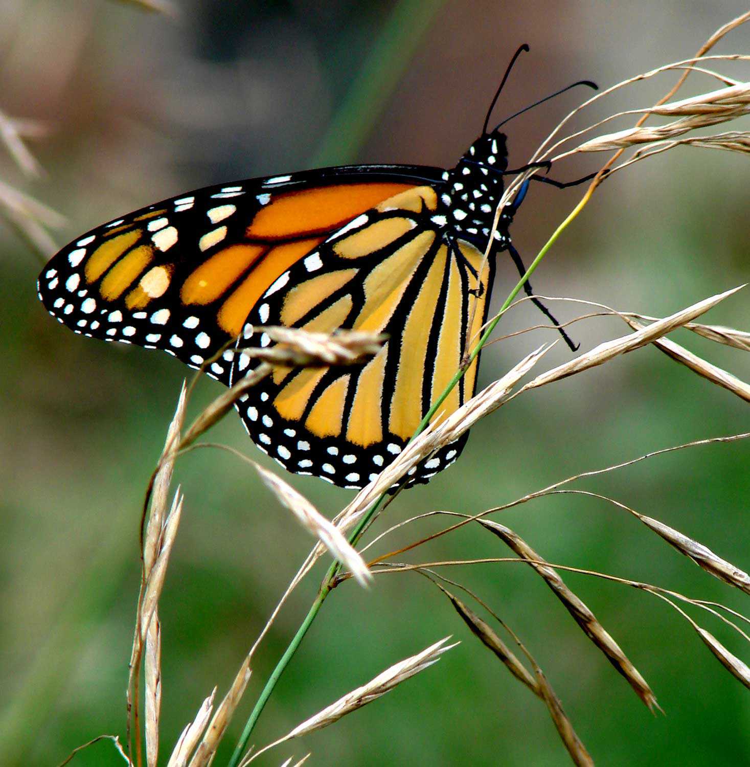
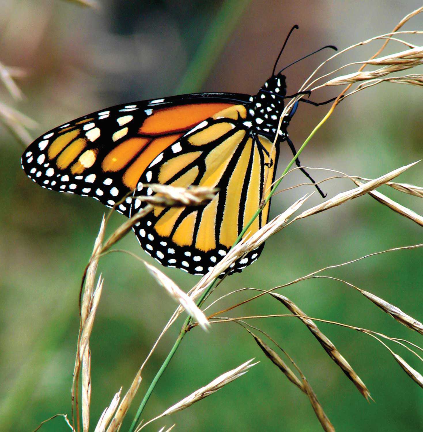
Species at risk: The monarch butterfly (danaus plexippus)
The beautiful Monarch butterfly is the most recognized butterfly in North America. What is not commonly known is that it is also a species at...![]()

- 15 Feb 2007
- Environment
Natural heritage - Author: Paula Terpstra,
Along the Oak Ridges Moraine Trail
Hiking along the Oak Ridges Moraine Trail offers a memorable experience. Situated close to the Greater Toronto Area, the Trail provides an opportunity to encounter...![]()
- 15 Feb 2007
- Black heritage
Buildings and architecture
Natural heritage - Author: Gordon Pim,
Heritage by numbers
Ontario’s heritage is an immense and complex jigsaw puzzle. Every individual element of heritage creates a whole . . . a sort of heritage by...![]()
- 07 Sep 2006
- Women's heritage
Arts and creativity
Natural heritage - Author: Gordon Pim,
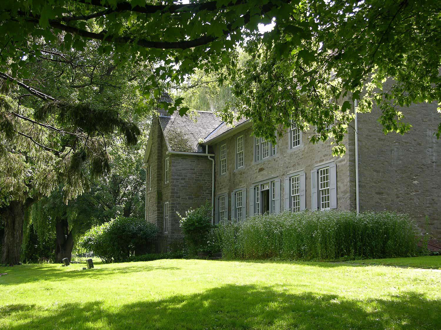
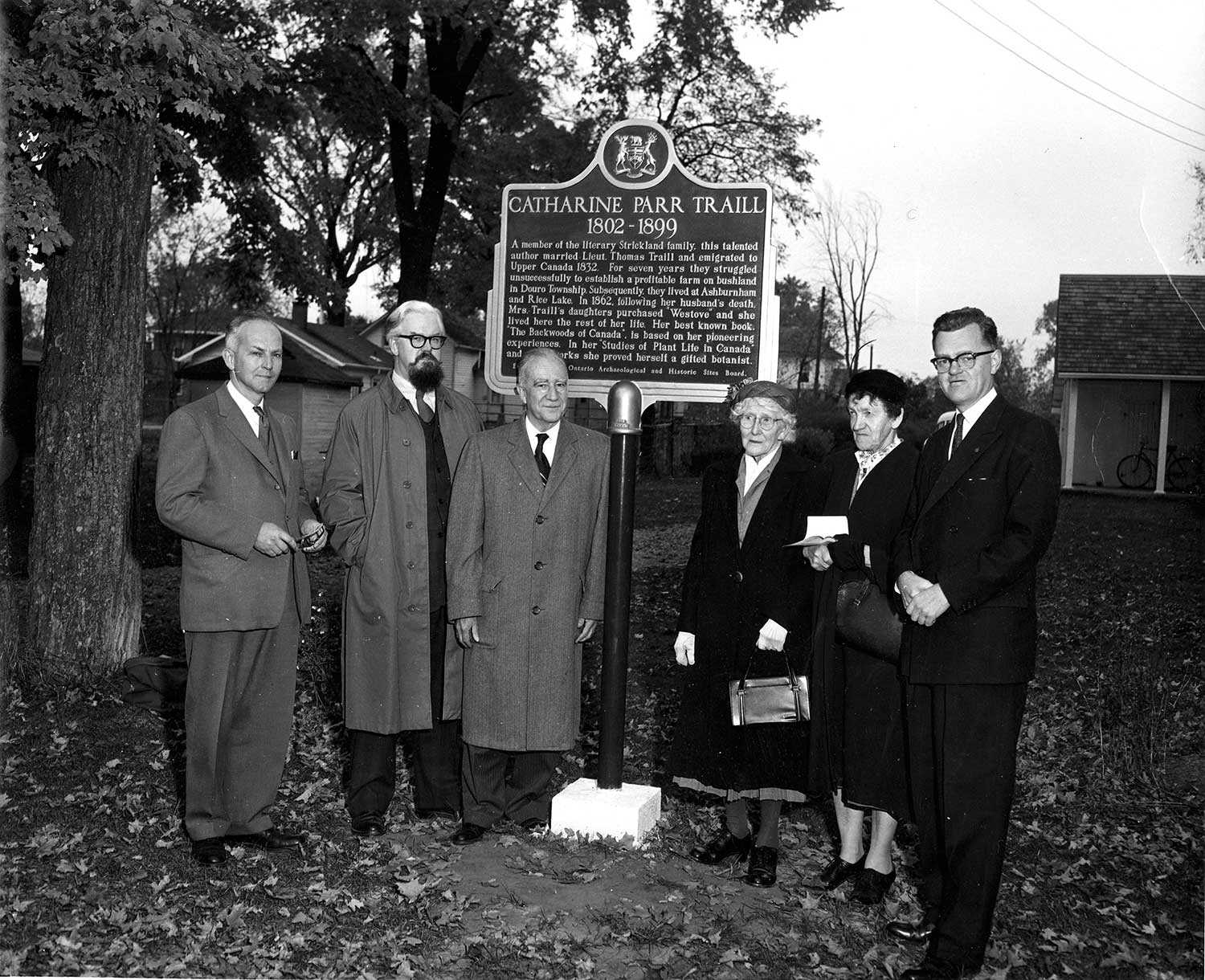
Literary giants
Catharine Parr Traill is one of Canada’s literary luminaries. Her life story spans most of the 19th century, crossing oceans, battling cholera and journeying through...![]()
- 25 May 2006
- Natural heritage
- Author: Catrina Colme,
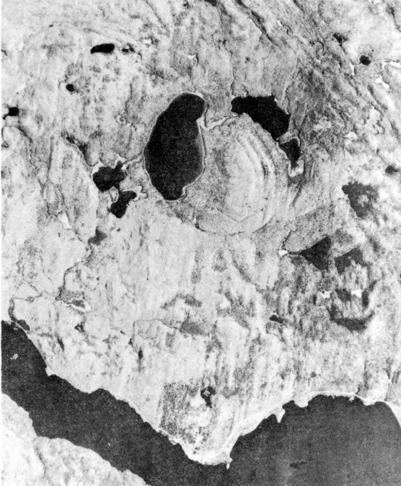
Giant meteorite slams Algonquin Park
Well, that would have been the headline 450 million years ago. Today, it is a fascinating mark on our natural landscape. This is not a...![]()

- 25 May 2006
- Environment
Natural heritage - Author: Tony Buszynski,
It’s not easy staying green: Working for a green and healthy Ontario
Natural heritage conservation can be traced back to the early times of the First Nations, whose close relationship with nature was reflected in religious beliefs...![]()
- 25 May 2006
- Natural heritage
- Author: Fran Moscall,
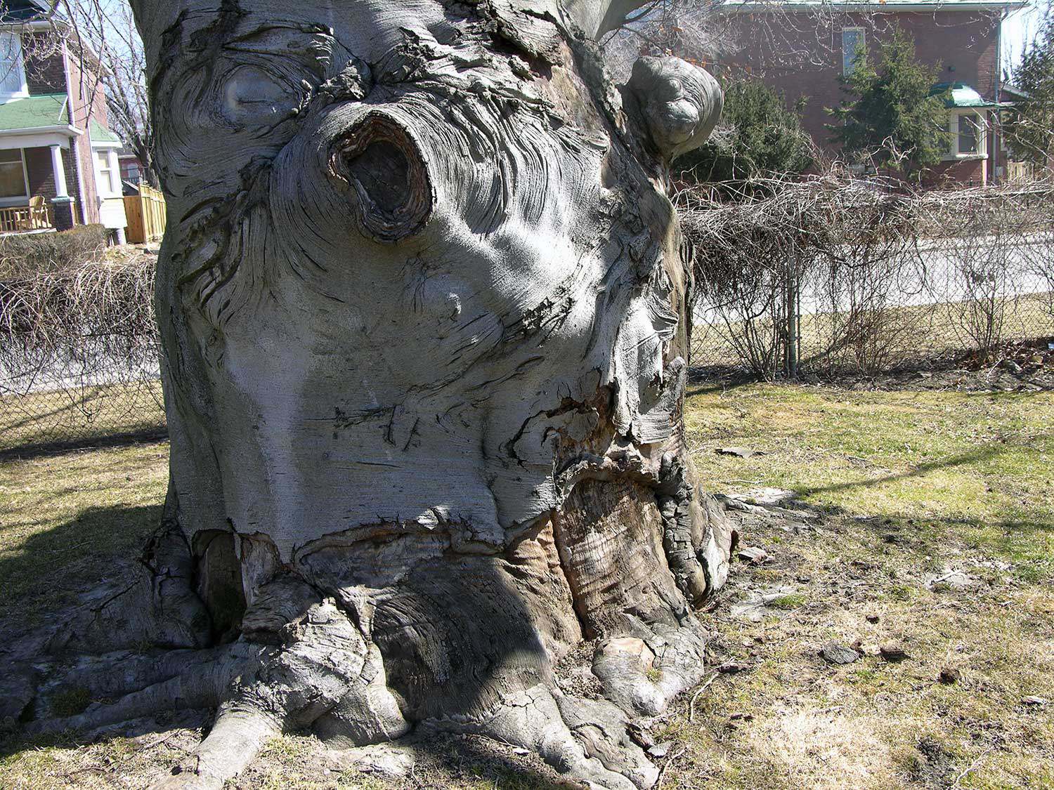
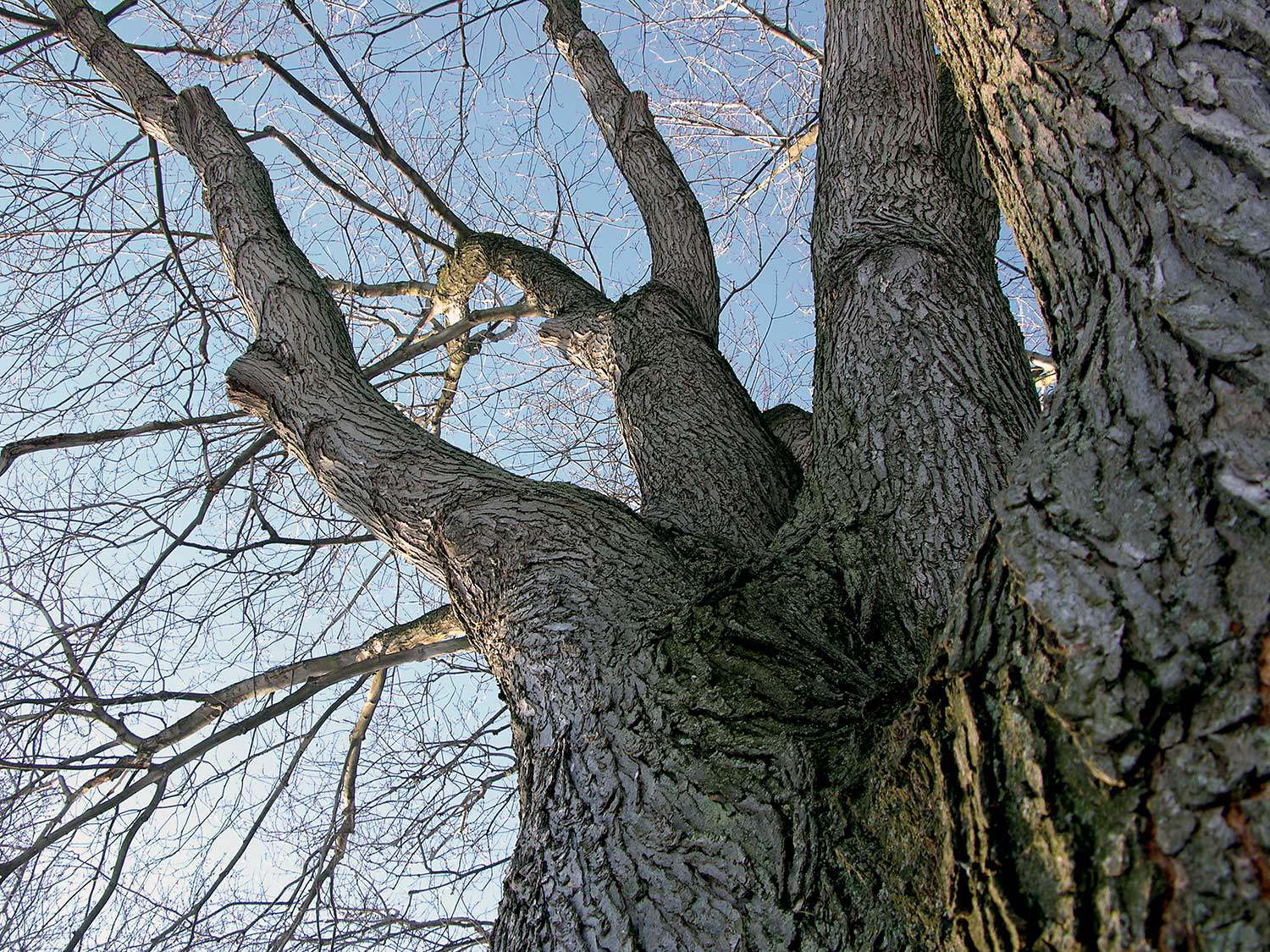
Remarkable trees – Heritage tree preservation in Ontario
What is heavier than any land animal, taller than most buildings, older than many ancient monuments? One of the world’s oldest living organisms are –...![]()
- 25 May 2006
- Natural heritage
- Author: Paula Terpstra,
Making tracks
Ontario’s 64,000-km network of trails traverses a varied landscape of wilderness, rural and urban areas. These trails range from waterways and portage routes to footpaths...![]()
- 25 May 2006
- Natural heritage
- Author: Karen Abel,
Gardening for biodiversity
Many gardeners today are finding enjoyable and educational ways to participate in the promotion and preservation of Ontario’s natural heritage through the creation of habitat-inspired...![]()
- 25 May 2006
- Natural heritage
Tools for conservation - Author: Jeremy Collins,
The anatomy of a heritage conservation easement: Building the framework for a conservation partnership
Private landowners are often faced with a difficult dilemma – how to preserve the heritage of their land for future generations in a world where...![]()
- 25 May 2006
- Natural heritage
- Author: Barbara Heidenreich,
Our provincial tree: The eastern white pine
Builders of British sailing ships during the 1800s sought the tall, straight white pine for the masts. The best trees in British North America were...![]()
- 25 May 2006
- Natural heritage
- Author: Barbara Heidenreich,
Giving back to nature
Southwestern Ontario sustains the richest array of flora and fauna in the country. Known as Canada’s deep south, this area includes sassafras, flowering dogwood, tulip...![]()
- 25 May 2006
- Natural heritage
- Author: Tony Buszynski,
Working together to save our natural heritage
With ongoing development pressures for housing, roads and commercial and industrial activities in Ontario, natural heritage protection has become more critical than ever before in...![]()
- 16 Feb 2006
- Environment
Natural heritage - Author: Ontario Heritage Trust,
Protecting natural spaces in Southern Ontario
On August 3, 2005 the provincial government announced the creation of the Natural Spaces Program, which included a $6-million allocation to the Ontario Heritage Trust...![]()
- 08 Sep 2005
- Buildings and architecture
Natural heritage
Community
Cultural landscapes - Author: Richard Moorhouse and Beth Hanna,
The new Ontario Heritage Act: The evolution of heritage conservation
An important shift has occurred in Ontario’s legislative framework for heritage conservation. On April 28, 2005, the Ontario Heritage Amendment Act (Bill 60) received royal...![]()
- 19 May 2005
- Natural heritage
- Author: Ontario Heritage Trust,
Visiting the Cheltenham Badlands
Nestled on the Niagara Escarpment amid the rolling countryside of the Caledon Hills lies a unique landscape locally known as the Cheltenham Badlands. The site...![]()
- 12 Feb 2005
- Natural heritage
- Author: Ontario Heritage Trust,
Gifts of nature
The Egbert Ross Boothby property Imagine a plot of land on the Lake of Bays, seemingly untouched by human habitation. It has almost a mile...![]()
- 12 Feb 2005
- Natural heritage
Community - Author: Ontario Heritage Trust,
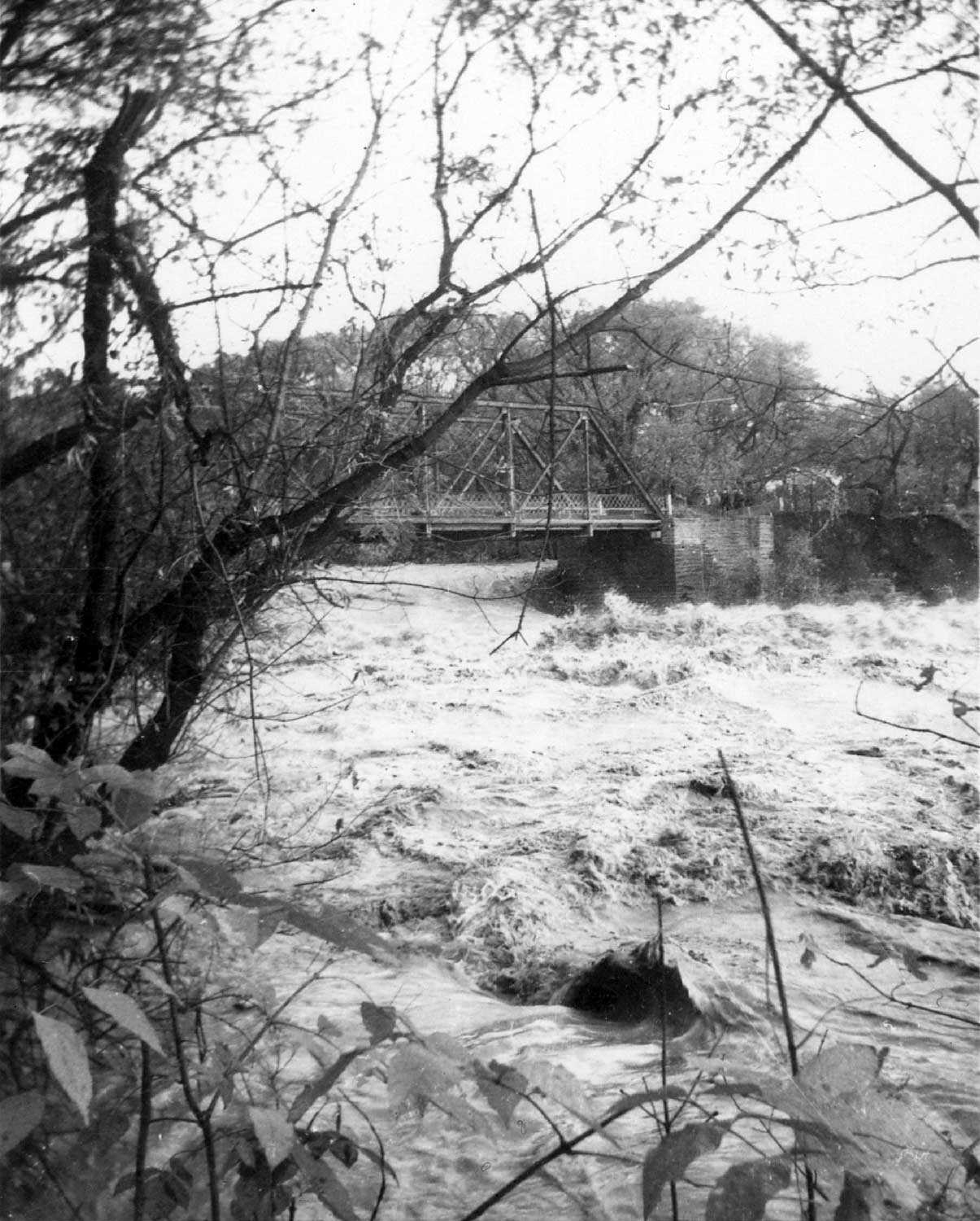
Hurricane Hazel 50 years later
There was little warning about Hurricane Hazel – one of the worst storms in Canada’s history. At the time, few Canadians paid attention to tropical...![]()
We're Social
Keep up with our latest news and information
- Accessibility
- Privacy statement
- Terms of use
- © King's Printer for Ontario, 2023
- Photos © Ontario Heritage Trust, unless otherwise indicated.
- Accessibility
- Privacy statement
- Terms of use
- © King's Printer for Ontario, 2023
- Photos © Ontario Heritage Trust, unless otherwise indicated.