


Browse by category
- Adaptive reuse
- Archaeology
- Arts and creativity
- Black heritage
- Buildings and architecture
- Communication
- Community
- Cultural landscapes
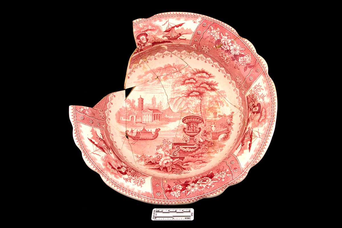
- Cultural objects
- Design
- Economics of heritage
- Environment
- Expanding the narrative
- Food
- Francophone heritage
- Indigenous heritage
- Intangible heritage
- Medical heritage
- Military heritage
- MyOntario
- Natural heritage
- Sport heritage
- Tools for conservation
- Women's heritage
- Home
- Adaptive reuse
- Archaeology
- Arts and creativity
- Black heritage
- Buildings and architecture
- Communication
- Community
- Cultural landscapes
- Cultural objects
- Design
- Economics of heritage
- Environment
- Expanding the narrative

Expanding the narrative
 This is part of a broader conversation about whose history is being told, about gender, people of colour and the economically disenfranchised, and others whose stories have been overlooked or intentionally omitted from the authorized discussion.
- Food
- Francophone heritage
- Indigenous heritage
- Intangible heritage
Intangible heritage
Intangible cultural heritage includes language, traditions, music, food, special skills, etc.
- Medical heritage
- Military heritage
- MyOntario
- Natural heritage
- Sport heritage
- Tools for conservation
- Women's heritage
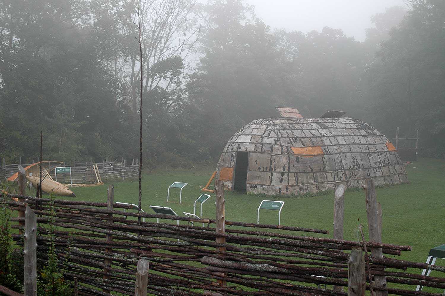
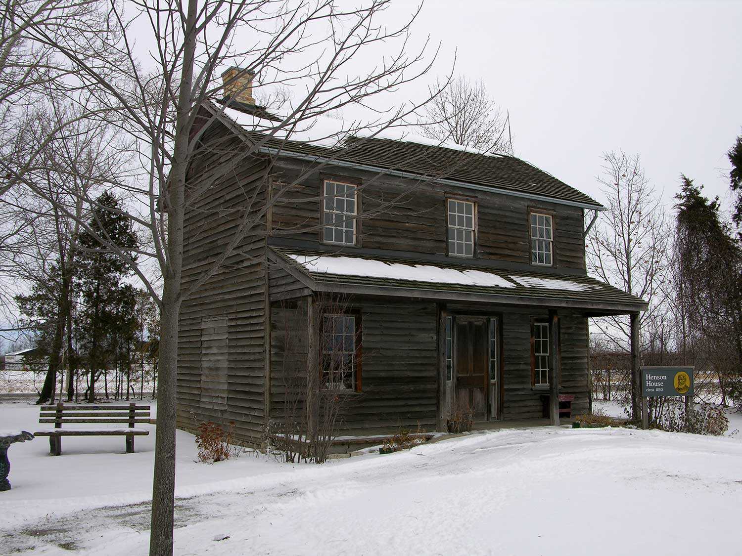
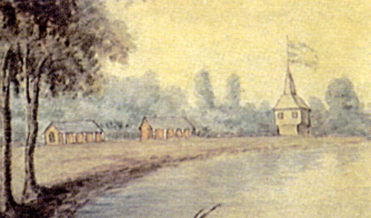
Breaking ground virtually: Looking through the Henson Family cemetery
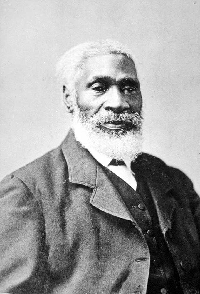
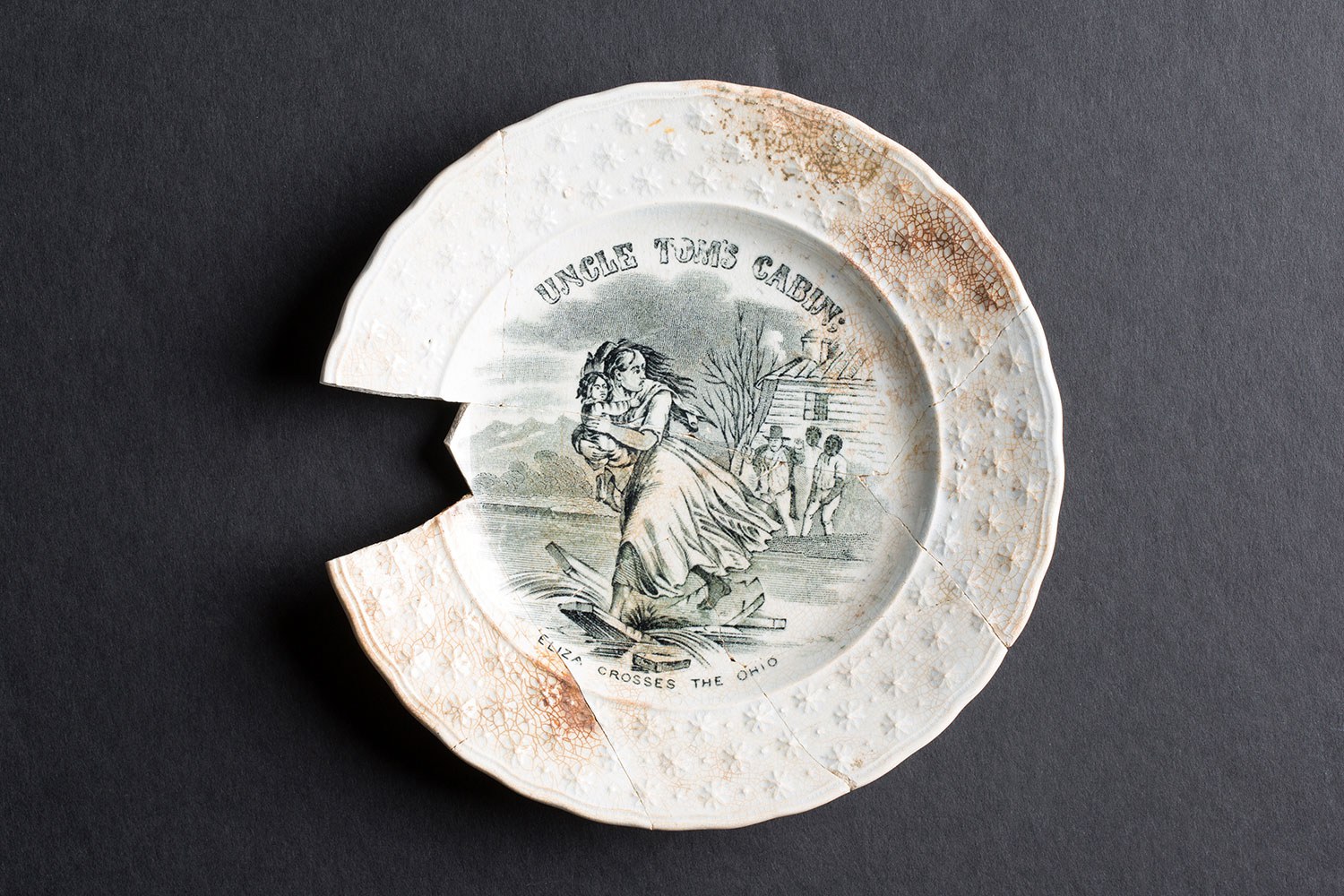
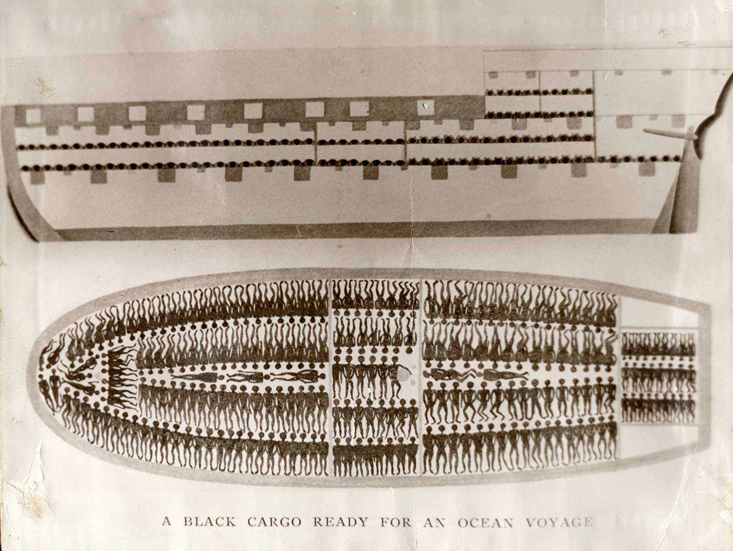
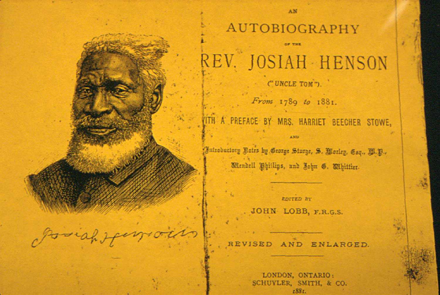
Many have forgotten how influential Harriet Beecher Stowe’s novel Uncle Tom’s Cabin was at the time of its 1852 publication. It was a catalyst for positive, radical change, encouraging society’s rejection of slavery in the United States and around the world. Shortly after the release of her book, Stowe acknowledged that Josiah Henson’s autobiography – published a few years earlier in 1849 – was the inspiration for her novel.
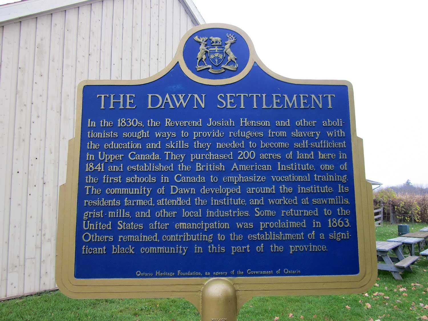
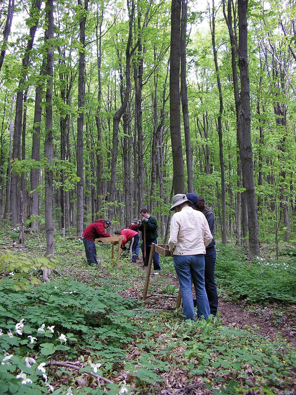
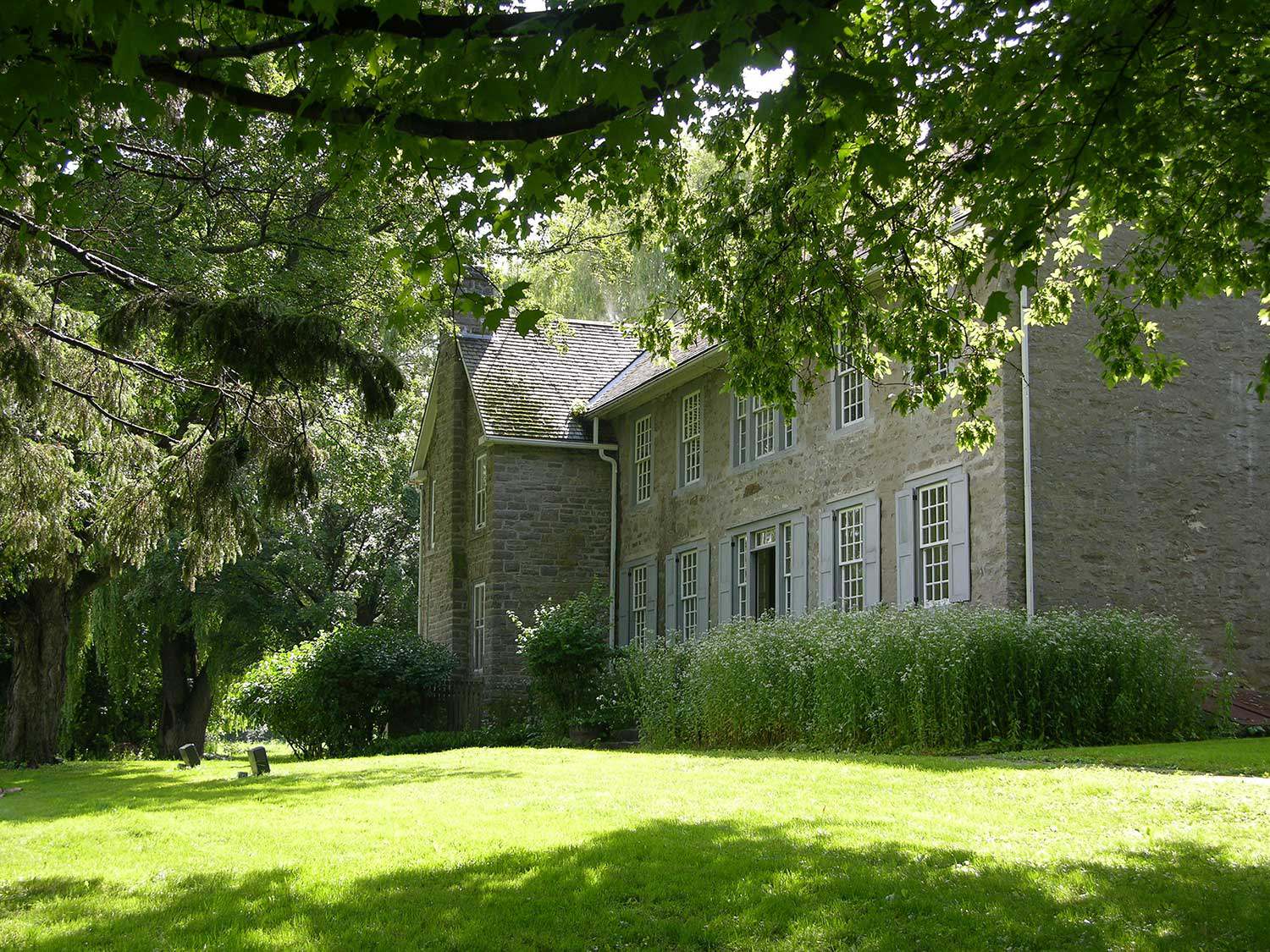
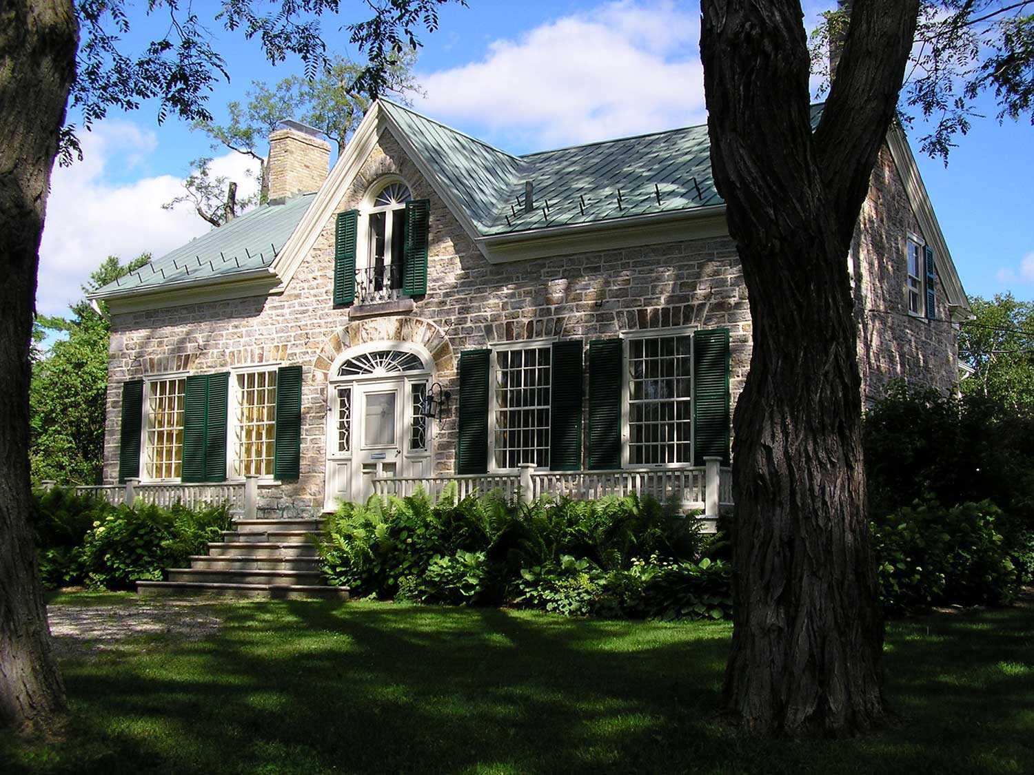
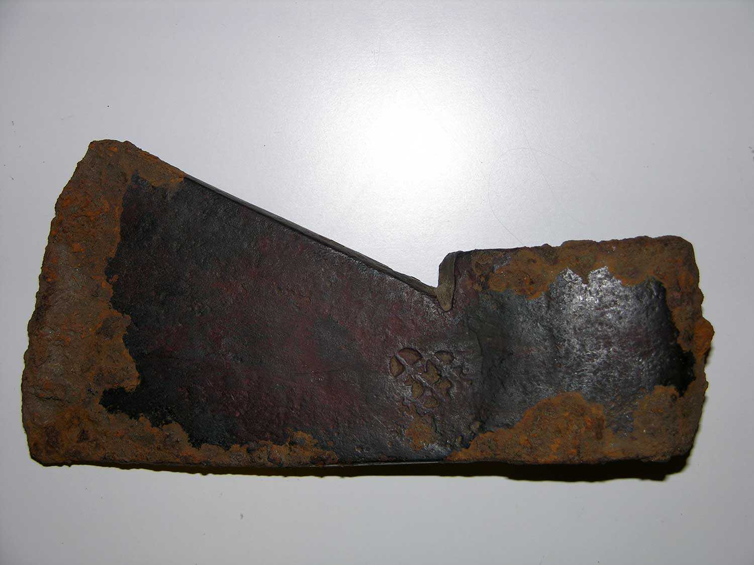
Josiah Henson was a renowned abolitionist, preacher, conductor on the Underground Railroad and one of the founders of the Dawn Settlement in Dresden, Ontario. Uncle Tom’s Cabin Historic Site, located at the heart of the Dawn Settlement, is owned and operated by the Ontario Heritage Trust. Adjacent to the property are two historic cemeteries related to the British American Institute and the Henson family. Within the Henson Family cemetery is the final resting place of Josiah Henson. It remains to this day an active cemetery for Henson’s descendants. But because records have been lost over the years, identifying the location of every burial on the site has proven to be problematic. Although many headstones are visible at the two cemeteries, their positions do not always precisely mark the location of the underlying graves.
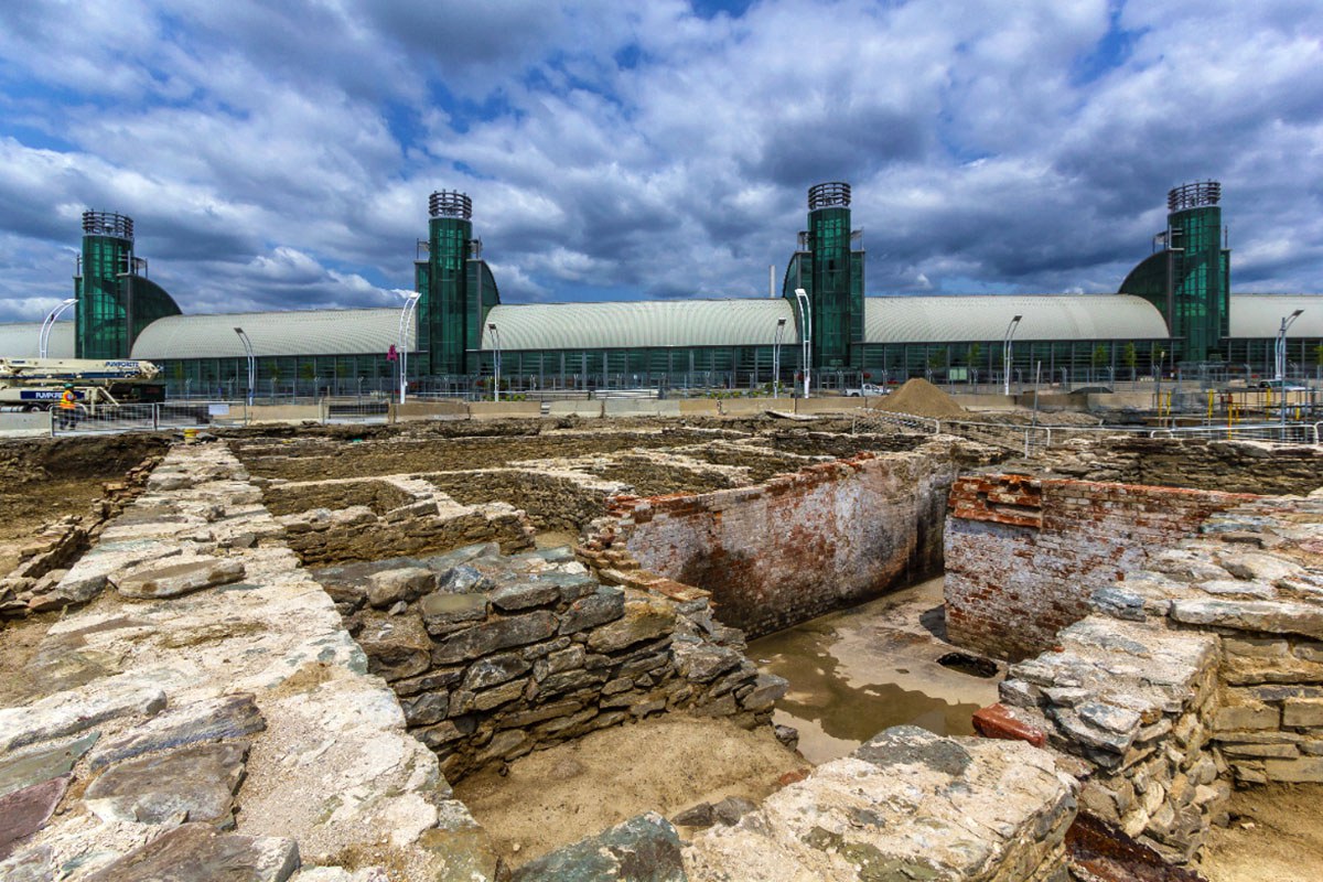
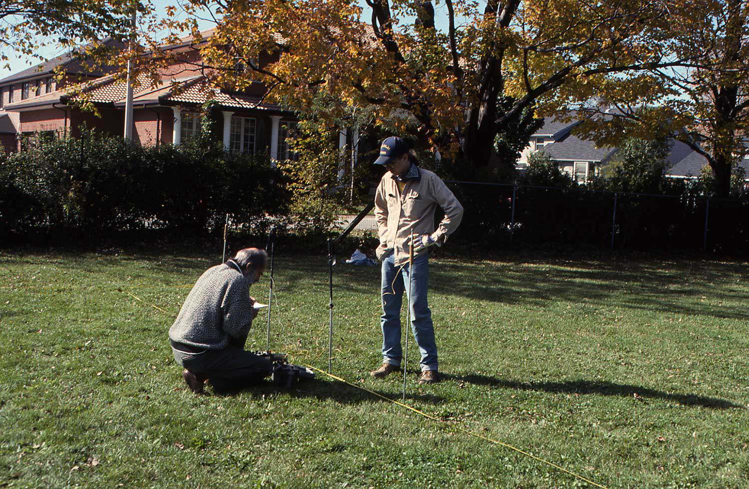
In partnership with Sustainable Archaeology at the University of Western Ontario, the Trust undertook an investigation of how many burials may exist below ground at the two cemeteries. Beginning in 2008, the first attempt involved utilizing a gradiometer under the direction of Edward Eastaugh, archeology supervisor and leader of Western’s survey team. A gradiometer survey in archaeology is based on the measurement of tiny anomalies in the earth’s magnetic field that are generated by human activity.
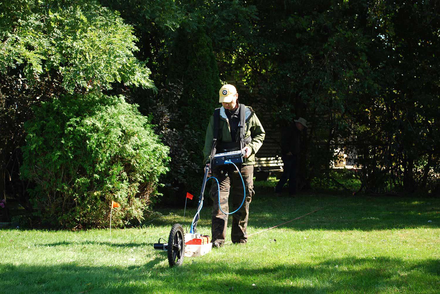
The results of the two gradiometer surveys at Uncle Tom’s Cabin Historic Site, while encouraging, remain inconclusive. Although numerous small anomalies were identified at both cemeteries, it is unclear whether these are the result of historical graves, a scattering of building material or a combination of the two. Interpretation of the results is also impeded due to the large number of iron objects in Using ground penetrating radar at the Henson Family Cemetery in 2011. Breaking ground virtually: Looking through the Henson Family cemetery By Dena Doroszenko the area, including recent interments; many areas of the survey were washed out by extremely high anomalies.
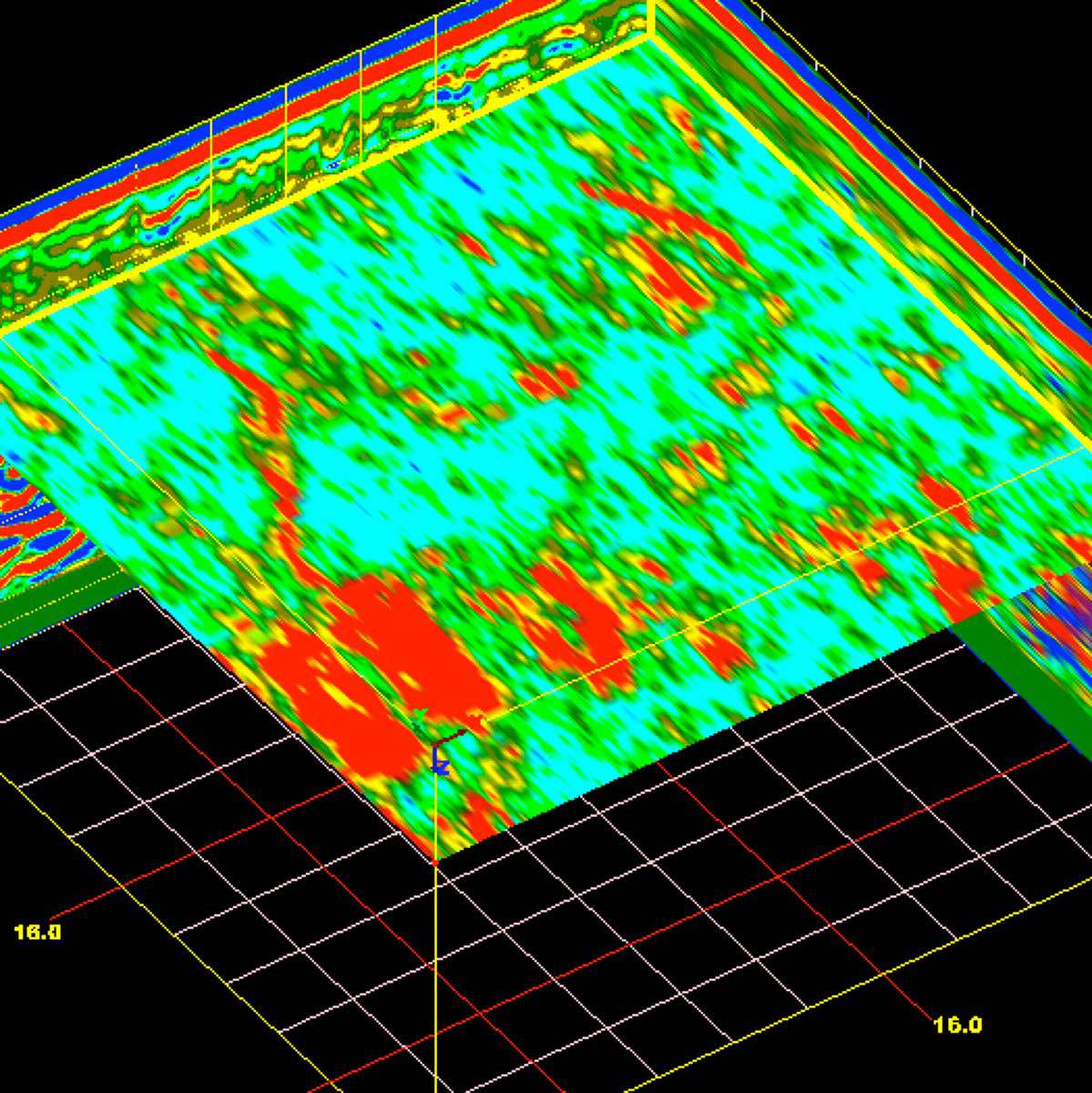
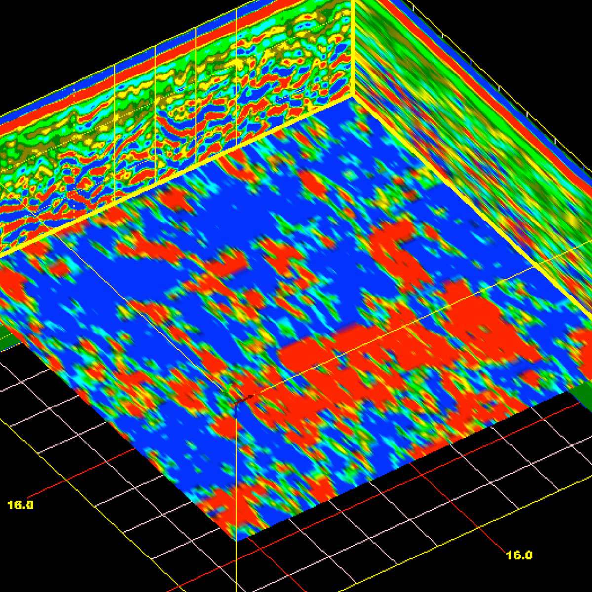
Given the mixed results from the first survey, the team returned to the Henson Family Cemetery on August 2, 2011 to conduct a survey using ground-penetrating radar (GPR). This technique involves the transmission of high frequency radar pulses from a surface antenna into the ground. The elapsed time between when this energy is transmitted, reflected from buried materials or soil changes in the ground, and then received back at the surface is then measured. When many thousands of radar reflections are measured and recorded, a three-dimensional picture of soil and feature changes can be created. This respectful approach minimizes surface disturbance – critical when mapping a historical cemetery.
Preliminary results from the 2011 GPR survey indicate that the Henson Family Cemetery contains a larger number of burials than was expected. Twenty-four headstones are visible at the cemetery. The images above show the results of the survey in one 10-metre by 10-metre grid section; these results were found to be typical across the cemetery. Burials marked by headstones were visible near the surface. Deeper in the ground, additional unmarked burial shafts were present. While only four were marked, it appears that at least 12 or more burials are evident.
Survey results will be made available to Uncle Tom’s Cabin Historic Site, the Henson family, Essex-Kent County and will be presented at the Society for Historical Archaeology conference in January 2012 in Baltimore, Maryland – not far from Henson’s birthplace. The team is hoping to return to Dresden in 2012 to complete a GPR survey of the British American Institute cemetery to advance our knowledge of the Dawn Settlement and the legacy of Josiah Henson.
RelatedStories
- 27 Jul 2022
- Expanding the narrative
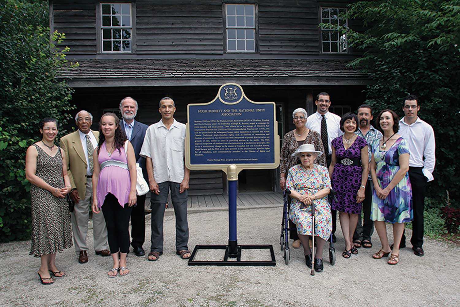
Black heritage - Author: Beth Hanna and Steven Cook,
Celebrating Josiah – Introducing the Josiah Henson Museum of African-Canadian History
“I’ll use my freedom well.” Josiah Henson made this promise to Captain Burnham, who helped him and his family in the last part of their...![]()
- 21 Apr 2022
- Expanding the narrative
Black heritage - Author: Beth Hanna,
Setting the record straight – Updating four Black history plaques
I’d like to tell you about Solomon Moseby. In 1837, Moseby fled to Niagara to escape slavery in Kentucky. When his extradition back to the...![]()
- 01 Oct 2019
- Economics of heritage
Archaeology
Community - Author: Donovan Rypkema,
Nine ways that heritage conservation is good for the economy
Advocates for heritage conservation have traditionally made their case on the basis of architectural character, cultural significance, social relevance, esthetic quality and other values of...![]()
- 07 Sep 2018
- Expanding the narrative
Black heritage - Author: Kendra Campbell,
To be dignified, stylish and Black in the 19th century was to defy expectations
In summer 2018, the Black Artists’ Networks Dialogue Gallery and Cultural Centre (BAND) presented Redefining Black Identity, an exhibit that featured 19th-century Black portraiture. The...![]()
![F 2076-16-3-2/Unidentified woman and her son, [ca. 1900], Alvin D. McCurdy fonds, Archives of Ontario, I0027790.](https://www.heritage-matters.ca/uploads/Articles/27790_boy_and_woman_520-web.jpg)
- 20 Mar 2018
- Women's heritage
Black heritage - Author: Natasha Henry,
We’ve always been here: Black women’s history of voting rights and politics in Canada
The history of Black women’s voting rights in Canada must be understood in the context of their evolving social status in the nation’s preceding French...![]()
- 20 Mar 2018
- Women's heritage
Black heritage - Author: Beth Hanna,
From Happy Hill to Parliament Hill: An interview with trailblazer Jean Augustine
Among her many accolades, the Honourable Jean Augustine has the distinction of being Canada’s first Black female Member of Parliament and Cabinet Minister. An educator...![]()
- 17 Feb 2017
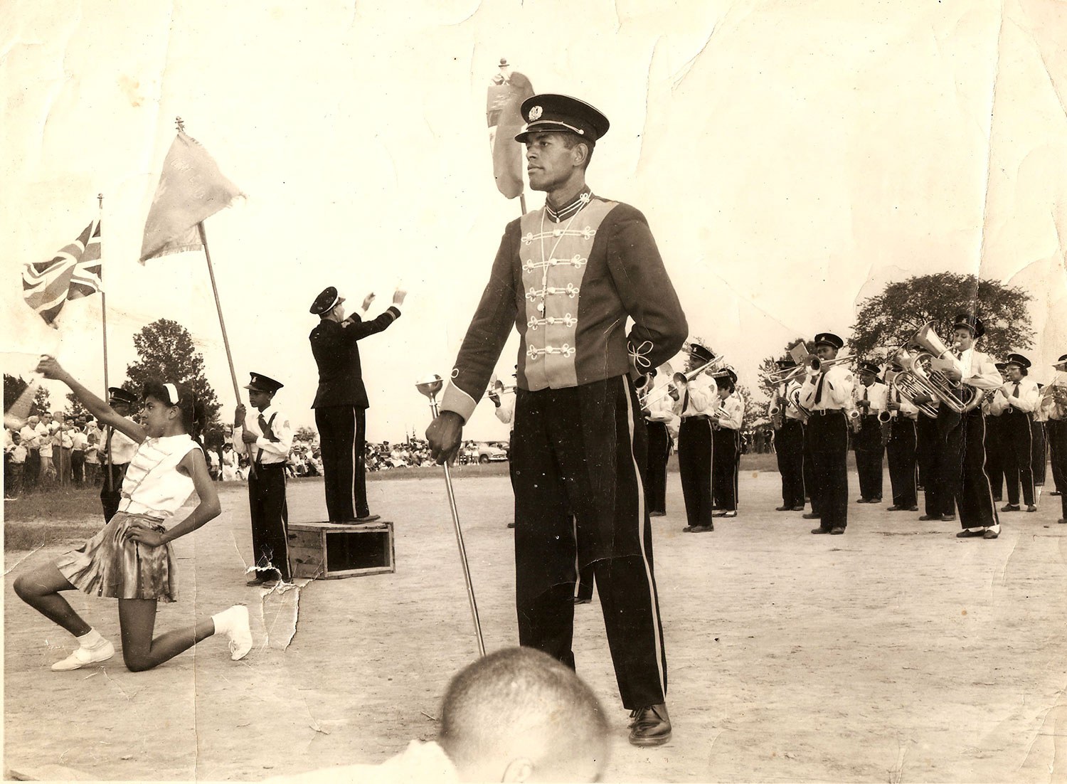
- Black heritage
MyOntario - Author: Holly Martelle,
Hopes for the future
My life as an archaeologist often consists of hour upon hour of painstaking analysis of small bits and pieces of everyday life. But last year...![]()
- 17 Feb 2017
- Indigenous heritage
Archaeology
MyOntario - Author: Jean-Luc Pilon,
The gift of time travel
In the summer of 1982, I was carrying out archaeological research near the shores of Hudson Bay on the Severn River. One of the sites...![]()
- 17 Feb 2017
- Archaeology
MyOntario - Author: William R. Fitzgerald,
A divine intersection of history and archaeology
Suspicion, fear, and intimidation met Jesuit priests Jean de Brébeuf and Pierre-Joseph-Marie Chaumonot during their Mission of the Angels to “la Nation Neutre” between November...![]()
- 17 Feb 2017
- Archaeology
MyOntario - Author: Dr. Patrick Julig,
Reflections on ancient quarry sites of northern Ontario
In the 1980s-90s, I excavated at Cummins and Sheguiandah National Historic Site quarry/ workshops in northern Ontario – in addition to many neat places elsewhere...![]()
- 17 Feb 2017
- Black heritage
MyOntario - Author: Adrienne Shadd,
Reflections on my hometown
In the year of the 150th birthday of Canada, I would like to pay tribute to my hometown. North Buxton started out in 1849 as...![]()
- 17 Feb 2017
- Black heritage
MyOntario - Author: Karolyn Smardz Frost,
Digging for the Promised Land
In 1985, the Toronto school board and Ontario’s culture ministry created the Archaeological Resource Centre. There, schoolchildren and volunteers could dig into their own city’s...![]()
- 17 Feb 2017
- Black heritage
MyOntario - Author: Dr. Afua Cooper,
The Black history of Ontario inspires me and defines who I am
Peggy Pompadour haunts me. I walk through the streets of Ye Olde Towne Toronto and I feel her presence – this Black enslaved woman who...![]()
- 09 Oct 2015
- Archaeology
- Author: Dr. Robert I. MacDonald,
Challenges of archaeological collections management
While buildings are among the most visible elements of heritage landscapes, they are frequently like the tip of the proverbial iceberg, associated with vast underground...![]()
- 09 Oct 2015
- Archaeology
- Author: Patryk Weglorz,
Resources: Revealing the past: Ontario's archaeological heritage
Online Archaeological Institute of America Canadian Archaeological Association Canadian Conservation Institute Canadian Museum of History Council for North Eastern Historical Archaeology (CNEHA) Historic England Huronia...![]()
- 09 Oct 2015
- Archaeology
- Author: Archaeology Program Unit at the Ministry of Tourism, Culture and Sport,
By the numbers
Archaeology is an important part of the planning and development process in Ontario. Each year, thousands of archaeological assessments are completed by licensed archaeologists to...![]()
- 09 Oct 2015
- Archaeology
- Author: Dr. Alicia Hawkins,
The history of archaeological investigations at the Thomson-Walker Site
Huronia – the point of land jutting out into the southern end of Georgian Bay – has caught the imagination of historians and archaeologists for...![]()
- 09 Oct 2015
- Archaeology
- Author: Lena Rye,
Breaking ground
On a July morning in 2010, an 11-year-old girl arrived at Toronto’s Spadina House. Excited and only slightly scared, she wondered what the next two...![]()

- 09 Oct 2015
- Archaeology
- Author: Martha Latta, Richard Zane Smith and Michel Savard,
Looking at archaeology from all angles
Every archaeological artifact tells its own unique story. But what it says can be – and is – interpreted differently, depending on who is examining...![]()
- 09 Oct 2015
- Archaeology
- Author: Ron Williamson,
Archaeology 101
What is archaeology? This may seem like a straightforward question, but you would be surprised with the answers that Canadians give to this question. In...![]()
- 05 Dec 2014
- Archaeology
Buildings and architecture - Author: Dena Doroszenko and Romas Bubelis,
Perspectives on a site: Artifacts, fragments and layers
When the Trust conserves a property as complex as Macdonell-Williamson House, we consider a variety of perspectives related to the site as an artifact –...![]()
- 15 Feb 2013
- Archaeology
Arts and creativity - Author: Katherine McIntyre,
Archeological treasure in a provincial park
Reprinted with permission (Windspeaker, Volume 28, Issue 4, 2010) North America’s largest collection of petroglyphs remained undisturbed for centuries. Then in 1954, three geologists out...![]()
- 18 May 2012
- Black heritage
Francophone heritage - Author: Emanuel da Silva and Diane Farmer,
Portrait of a growing diversity
Ontario has the largest number of francophones outside Québec. While that number has increased since 1951, it has not grown nearly as quickly as the...![]()
- 17 Feb 2012
- Black heritage
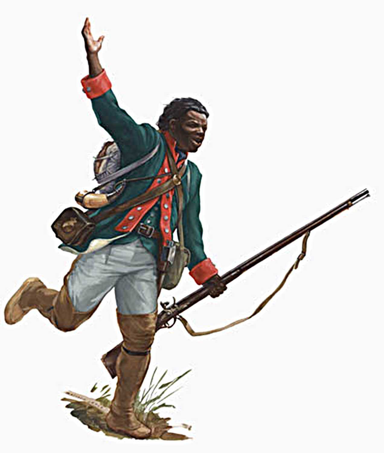
Military heritage - Author: Wayne Kelly,
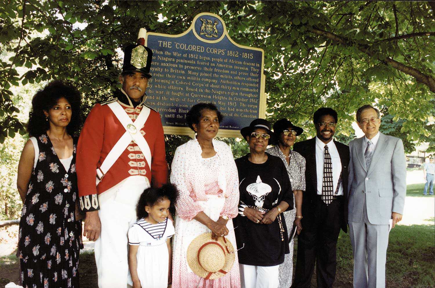
Fighting for freedom
What must Richard Pierpoint have thought in 1812 when he heard the war drums beating again? Abducted from Senegal at the age of 16, Pierpoint...![]()
- 10 Nov 2011
- Black heritage
- Author: Mesfin Aman,
A tribute to Dudley Laws
In February 2011, Dudley Laws checked himself out of hospital against medical opinion to honour a commitment previously made to inmates at Joyceville Institution in...![]()
- 10 Nov 2011
- Black heritage
Community - Author: Marie Carter,
Overcoming historical amnesia: Recognizing people of African descent as pioneers and community builders
Essential Canadian history often recognizes people of African descent solely through the heroic stories of the Underground Railroad. These stories alone, however, do not represent...![]()
- 10 Nov 2011
- Black heritage
- Author: P. Afua Marcus,
Len Gibson: Ontario dance pioneer
In this year declared by the United Nations as the International Year for People of African Descent, I think about dance in African Diaspora communities...![]()
- 10 Nov 2011
- Black heritage
- Author: Nina Reid-Maroney,
The life of the mind in the Promised Land
In the spring of 1861, a young black Philadelphian named Parker Theophilus Smith sold his belongings – including his extensive library of ethnography, history, mathematics...![]()
- 10 Nov 2011
- Black heritage
- Author: Rosemary Sadlier,
Recognition, justice and development
How do we recognize people of African descent in Ontario? How do we deal with their issues to provide them with justice? How do we...![]()
- 10 Nov 2011
- Black heritage
- Author: Karolyn Smardz Frost,
The UNESCO Slave Route Project: Itineraries of African-Canadian memory
In honour of the United Nations’ designation of 2011 as the International Year for People of African Descent, the Harriet Tubman Institute for Research in...![]()
- 10 Nov 2011
- Black heritage
- Author: Ontario Heritage Trust,
Resources: Celebrating the International Year for People of African Descent
What's on the shelf The Journey from Tollgate to Parkway: African-Canadians in Hamilton, by Adrienne Shadd (Dundurn Press Ltd. 2010) When the Lincoln Alexander Parkway...![]()
- 10 Nov 2011
- Black heritage
- Author: Thando Hyman,
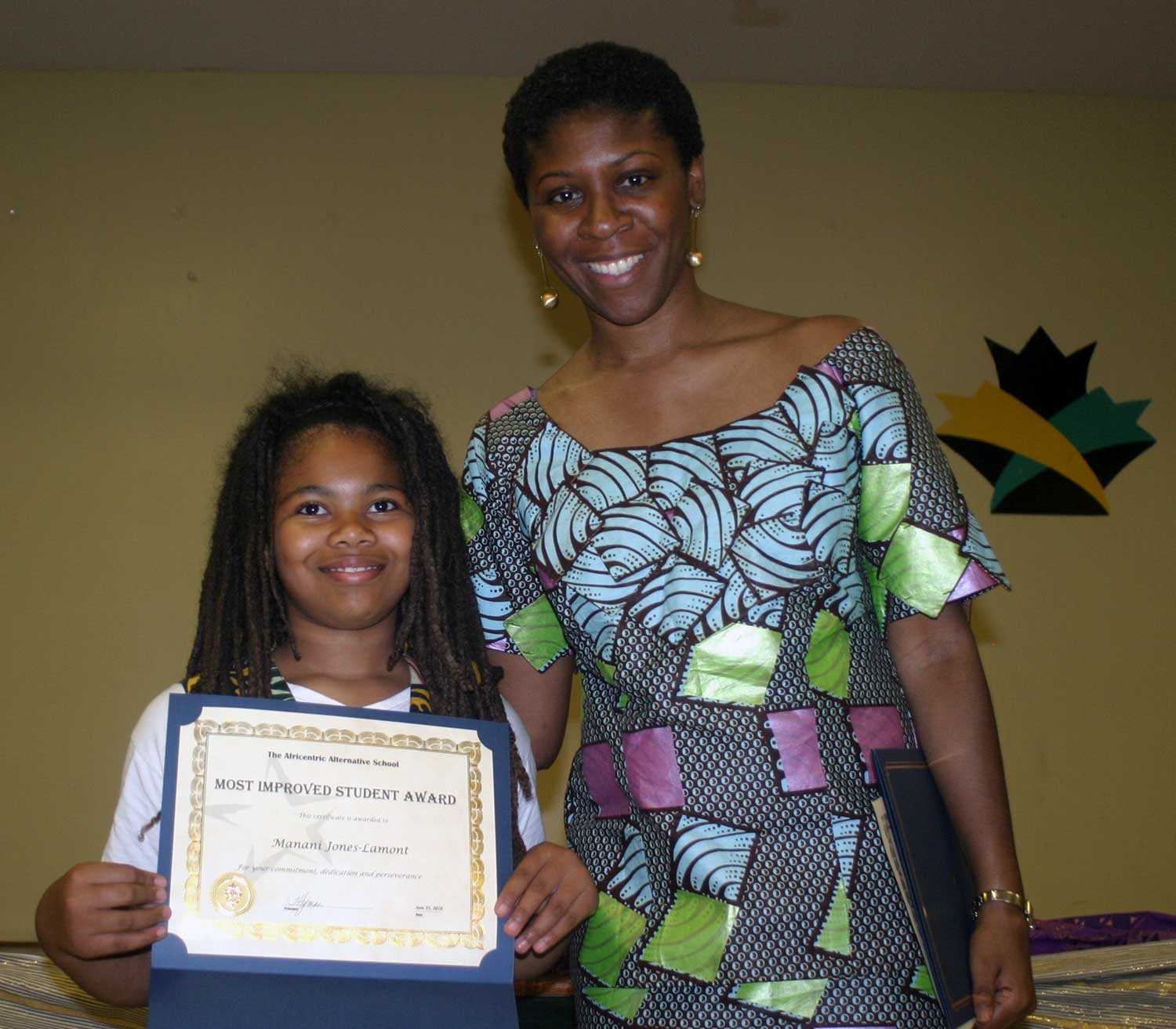
The journey of the Africentric Alternative School
As traditional approaches to education continued to negate, under-represent and marginalize the contributions of African-Canadians, vocal critics of the report entitled Toward a New Beginning...![]()
- 10 Nov 2011
- Black heritage
- Author: Dr. Afua Cooper,
Celebrating the International Year for People of African Descent
The United Nations (UN) has designated 2011 as the International Year for People of African Descent. The UN recognizes that, worldwide, people of African heritage...![]()
- 10 Nov 2011
- Black heritage
- Author: Sam Wesley,
Changing perspectives on the past
The Ontario Heritage Trust’s provincial plaque program has existed for more than 50 years. Throughout this time, it has commemorated several people, places and events...![]()
- 10 Nov 2011
- Women's heritage
Black heritage - Author: Adrienne Shadd,
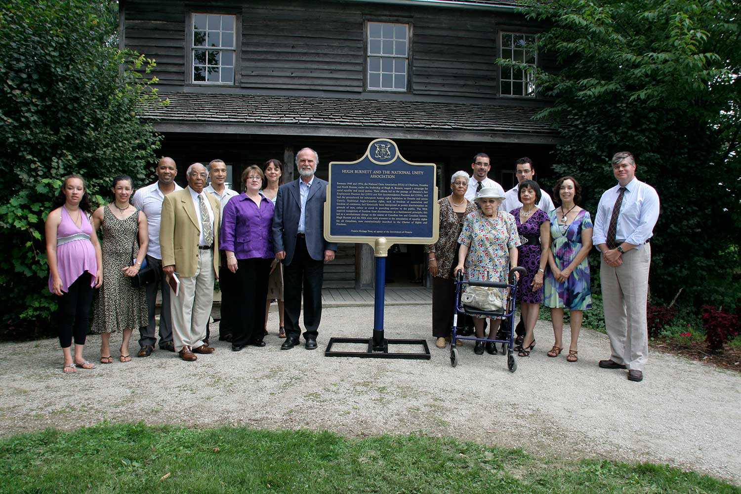
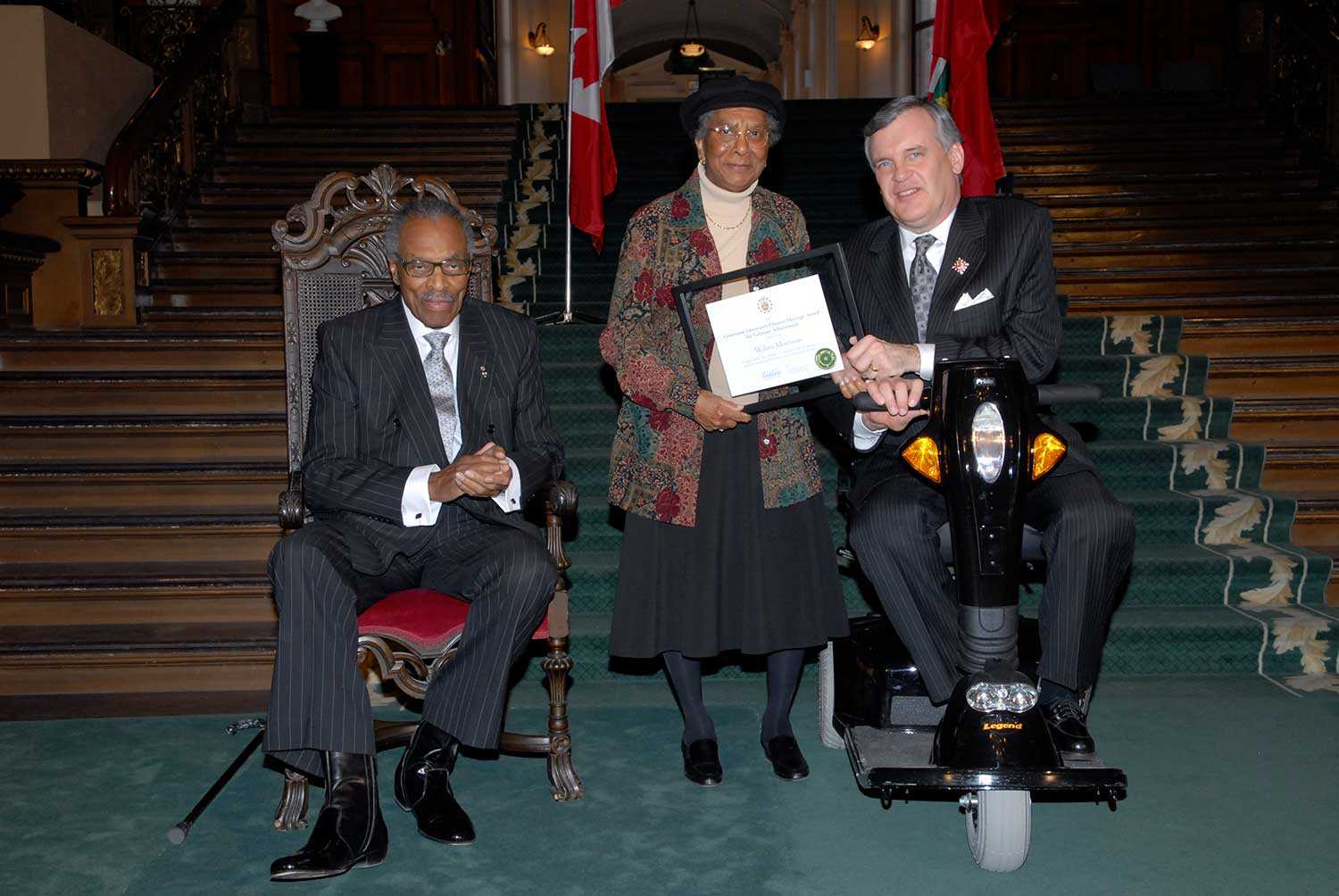
Wilma Morrison: A life of activism
By now, many people in the heritage community and the city of Niagara Falls, Ontario are familiar with the woman who is practically synonymous with...![]()
- 10 Nov 2011
- Black heritage
- Author: Tamari Kitossa,
Looking beyond the law
This International Year goes beyond recognizing the contributions that African-descended people have made toward the economic, cultural and material enrichment of the West. It is...![]()
- 31 May 2011
- Archaeology
Tools for conservation - Author: Dena Doroszenko,
Seeing the unseen: Archaeology and geophysics
As population growth results in substantial impact to Ontario’s landscapes, efficient and cost-effective methods to locate, map and acquire information from archaeological sites are needed...![]()
- 11 Feb 2010
- Indigenous heritage
Archaeology - Author: Robert Pearce,
The archaeology of southwestern Ontario
Southwestern Ontario has an extremely rich and diverse cultural history dating back 11,000 years. We can follow human history and settlement through archaeology in this...![]()
- 14 Feb 2008
- Black heritage
- Author: Steven Cook,
Ontario’s Black heritage network
In 2007, the Ontario Heritage Trust undertook a number of initiatives, with funding support from the Ministry of Citizenship and Immigration, to commemorate the 200th...![]()
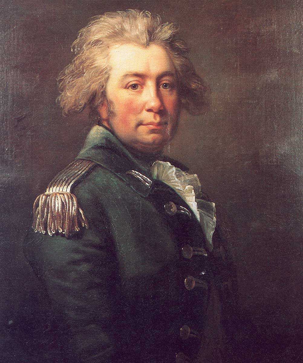
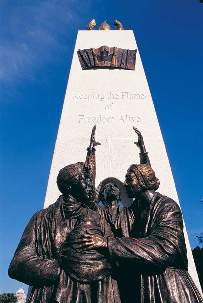
- 27 Jul 2007
- Black heritage
- Author: Colin McCullogh,
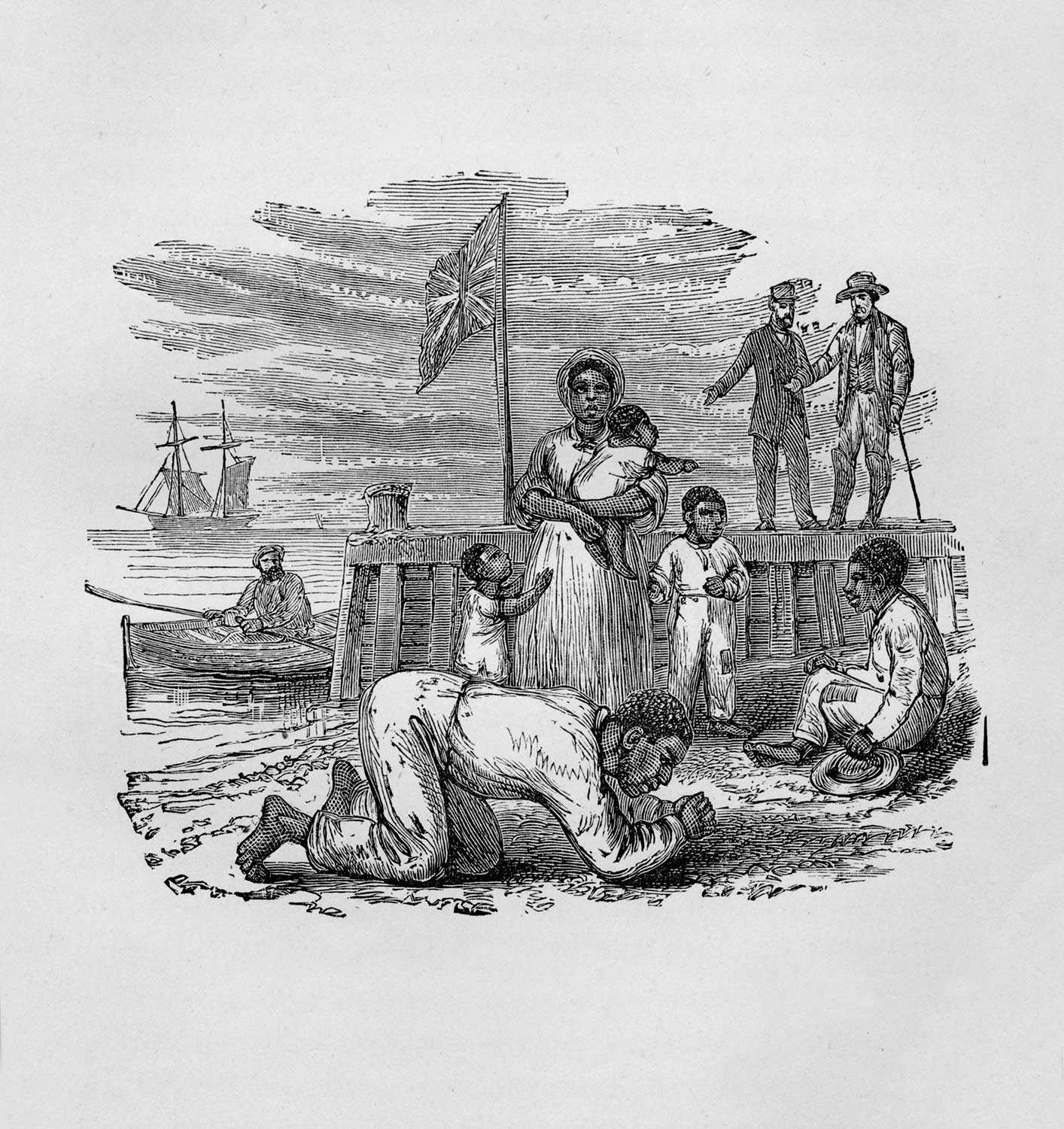
Chloe Cooley and the limitation of slavery in Ontario
On March 14, 1793 Chloe Cooley, an enslaved Black woman in Queenston, was bound, thrown into a boat and sold across the river to a...![]()
- 27 Jul 2007
- Black heritage
- Author: Ontario Heritage Trust,
Timeline to freedom
3500 BC to 332 BC – Slavery is practised in ancient Egypt as prisoners are sold as slaves 1500s – Beginning of the European slave...![]()
- 27 Jul 2007
- Black heritage
- Author: Dr. Afua Cooper,
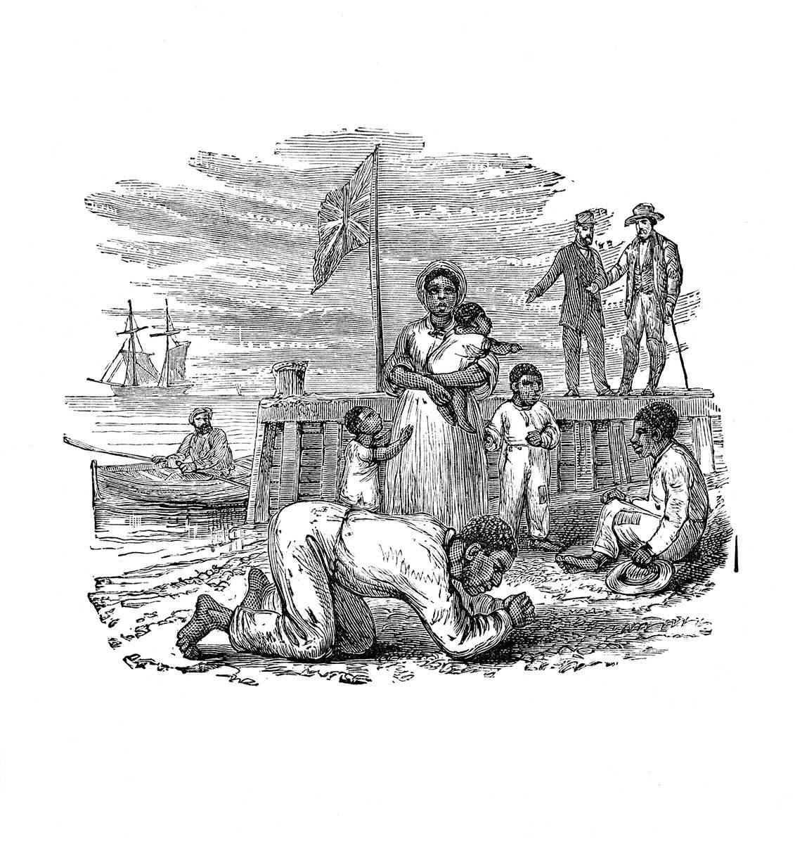
Slavery in Ontario
Slavery – one of the world’s oldest institutions, practised in almost every society – became increasingly identified with the Black peoples of Africa because of...![]()
- 10 May 2007
- Archaeology
Natural heritage - Author: Dena Doroszenko and Sean Fraser,
Tools through time: Protecting the past for the future
Identifying and protecting places in our communities that have cultural heritage value is an important part of managing change. Heritage buildings, archaeological sites and cultural...![]()
- 15 Feb 2007
- Black heritage
Cultural objects - Author: Wayne Kelly and Steven Cook,
Carving out a place in our history
Josiah Henson travelled to London, England in 1851 to attend the first World’s Fair – also known as the Great Exhibition or Crystal Palace Exhibition...![]()
- 15 Feb 2007
- Black heritage
Buildings and architecture
Natural heritage - Author: Gordon Pim,
Heritage by numbers
Ontario’s heritage is an immense and complex jigsaw puzzle. Every individual element of heritage creates a whole . . . a sort of heritage by...![]()
- 15 Feb 2007
- Archaeology
Cultural objects - Author: Dena Doroszenko,
Underground discoveries
In a wooded area near Coldwater, an archaeological site known as Thomson-Walker lies beneath the forest floor. The property on which the site is situated...![]()
- 07 Sep 2006
- Archaeology
- Author: Dena Doroszenko,
Uncovering family history
Built in Perth in 1823, Inge-Va represents one of the finest Neo-Classical Georgian houses in Eastern Ontario. In its refined, park-like setting, the house also...![]()
- 07 Sep 2006
- Black heritage
- Author: Steven Cook,
"I'll use my freedom well"
A world-class exhibit honouring a Canadian of national historic significance was launched this spring at the internationally renowned Uncle Tom’s Cabin Historic Site in Dresden...![]()
- 16 Feb 2006
- Black heritage
- Author: Karolyn Smardz Frost,
The birth of Black History Month
Ontario’s Black History Month began in the United States as “Negro History Week.” This American celebration of Black history and culture was initiated in 192...![]()
- 16 Feb 2006
- Archaeology
Buildings and architecture
Cultural objects
Tools for conservation - Author: Romas Bubelis,
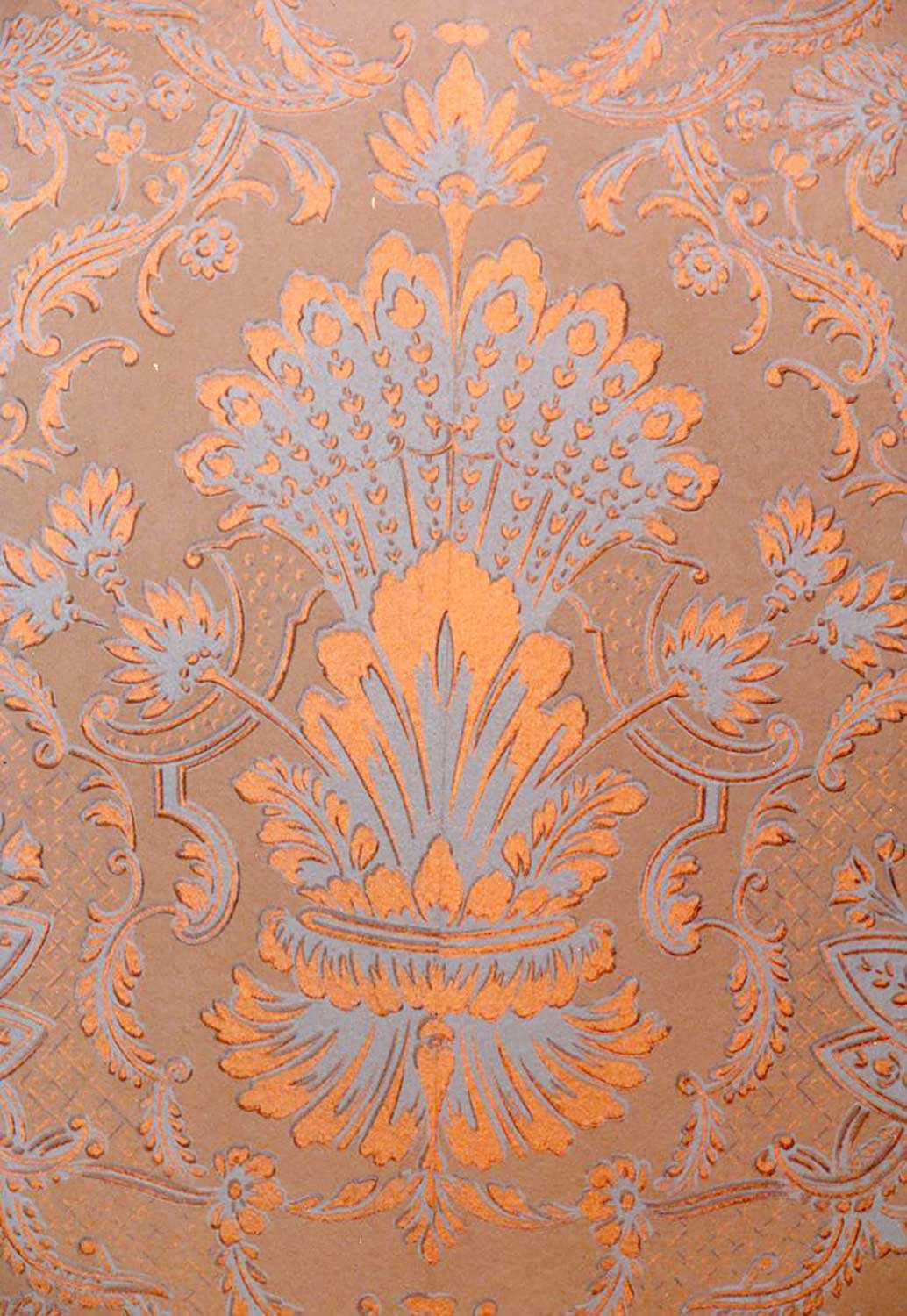
Historic wallpaper: Finding what’s beneath
Wallpapers first appeared in Canada as early as the mid-17th century. These oldest papers were block-printed, hand-painted or stenciled. Pattern and colour was applied to...![]()
- 16 Feb 2006
- Archaeology
Buildings and architecture - Author: Ontario Heritage Trust,
Breaking news: Saving our First Parliament
It was announced on December 21, 2005 that the site of Ontario’s first parliament buildings in Toronto has been saved. The Ontario Government, in partnership...![]()
- 16 Feb 2006
- Archaeology
Cultural objects
Tools for conservation - Author: Dena Doroszenko,
Digging up yesterday
Reesor live on a property near Bass Lake, Ontario that is protected by an Ontario Heritage Trust natural heritage easement. They lovingly care for this...![]()
- 08 Sep 2005
- Archaeology
Buildings and architecture - Author: Dena Doroszenko,
Unearthing the past: Discoveries at Macdonell-Williamson House
Built in 1817, Macdonell-Williamson House in eastern Ontario reflects the ambitions and aspirations of retired fur trader, John Macdonell. His life was fraught with financial...![]()
- 08 Sep 2005
- Black heritage
- Author: Steven Cook,
Celebrating Emancipation Day: The greatest freedom show on earth
His name was Walter Perry; they called him "Mr. Emancipation." Born in Windsor in 1899, this great-grandson of slaves drew thousands of spectators each year...![]()
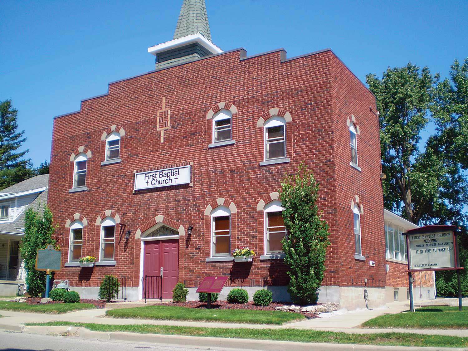
- 12 Feb 2005
- Black heritage
Buildings and architecture - Author: Wayne Kelly,
Inside Uncle Tom's Cabin
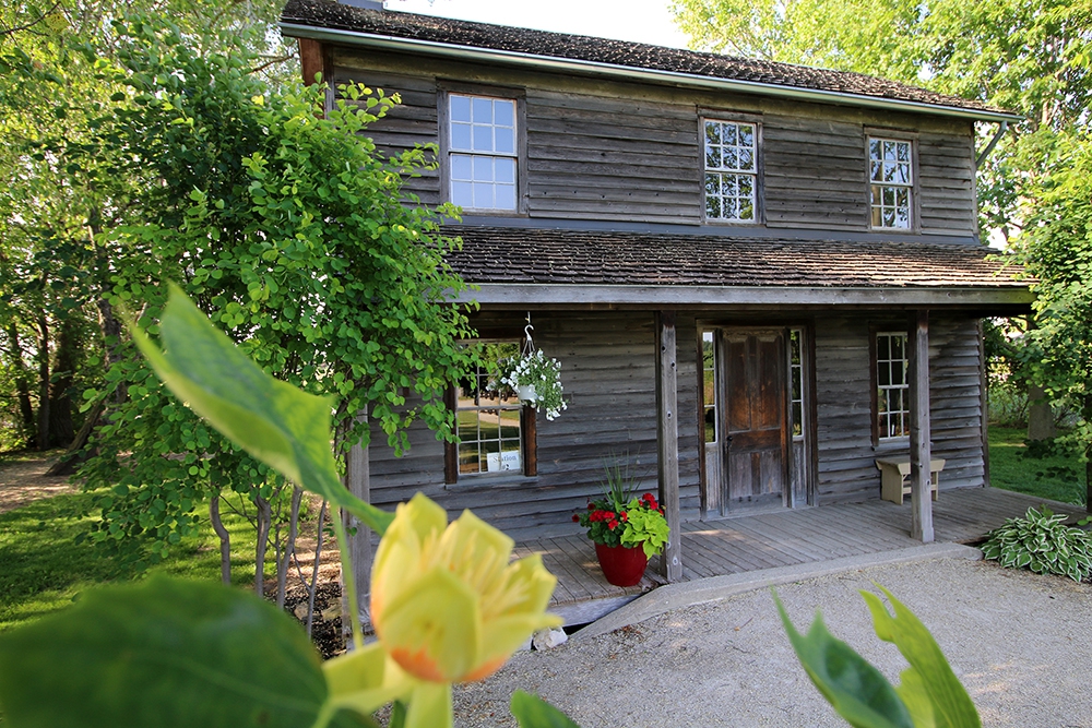
At a bend in the Sydenham River near the town of Dresden stands Uncle Tom’s Cabin Historic Site. The museum – built on the site...![]()
We're Social
Keep up with our latest news and information

- Accessibility
- Privacy statement
- Terms of use
- © King's Printer for Ontario, 2023
- Photos © Ontario Heritage Trust, unless otherwise indicated.
- Accessibility
- Privacy statement
- Terms of use
- © King's Printer for Ontario, 2023
- Photos © Ontario Heritage Trust, unless otherwise indicated.